-
Welcome to the Dundee Satellite Station
Dundee Satellite Station Ltd is a commercial ground station operating from the former RAF Errol airfield and offering a range of services to the UK and International Space sector.
You can find our Latest Images updated several times daily, and the local Weather Station updated half hourly
![Errol site Photo of 4 antennas on the Errol site]()
Errol site viewed from the north -
Refresh in 05:00 minutes.
-
History of Dundee Satellite Station Ltd
Background
Dundee Satellite Station Ltd was formed in July 2019 by Neil Lonie and Paul Crawford, former staff of the Dundee Satellite Receiving Station (DSRS) at the University of Dundee. Neil and Paul had worked at DSRS for 30 years prior to the creation of Dundee Satellite Station Ltd and have considerable experience in the design, construction, and operations of satellite ground stations. Over that period we and our former colleagues built not just the DSRS facility, but numerous other systems for other organisations world-wide for environments as diverse as Antarctica (both British and Italian Antarctic research facilities) thorough to Egypt (Food and Agriculture Organisation project). In addition we have supported various research and development projects for organisations such as ESA, Eumetsat, NASA and NOAA. The station had a success rate of 99.99% in acquiring data.Looking Forward
When the University decided to close the DSRS in 2019, Neil & Paul reached an agreement to acquire all the station’s assets and used them to set up the new base station on a site at Errol, near Dundee. In doing this they were helped by a GoFundMe campaign which was started to maintain public access to the Earth Observation data. Dundee Satellite Station plans to continue providing support to small satellite operators and to the vast community of former users of DSRS and its collection of Earth Observation data.DSS Ltd is also grateful for the generous support from the GEO society and our progress was covered in their magazine (linked here as 13MB PDF documents):
• GEO Quarterly Newsletter No 65 (March 2020, page 19)
• GEO Quarterly Newsletter No 67 (September 2020, page 10)
• GEO Quarterly Newsletter No 72 (December 2021, page 32)
By the end of 2021 DSS Ltd received support where Michelin development backs Dundee satellite ground stations start-up
You can also find our Blog Page updated occasionally with progress and news of interest relating to the new site.
Legacy of DSRS
The old DSRS station web site is partially preserved by the wayback machine, as seen here DSRS (archived)
For those interested in the closure of the DSRS itself, further details can be found in these articles:
• Over 40 years of service axed for the sake of £338,000
• Snatching defeat from the jaws of victory
• Jodrell Bank goes full UNESCO while Dundee awaits the decomissioners
• How the Dundee Satellite Receiving Station might rise once more
• Resurrected Dundee Satellite Station to host quantum Optical Ground Station
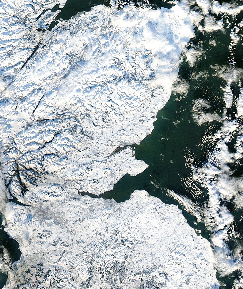
Also very well covered in Spaceflight magazine Vol.61 No.6An example of an Earth Observation image that we received at DSRS (part of a larger image made famous by the newspaper coverage) is shown here, with the centre of the image being roughly where the new site is located:
![Scotland covered in snow Scotland covered in snow]()
-
What is new at Dundee Satellite Station Ltd
Here we occasionally write about things that are happening that we hope folks will find of interest!
Antenna Fault (8 Feb 2026, updated 21 Feb 2026, 25 Feb 2026)
The antenna we currently use for the daily Earth Observation pictures developed a fault on Sunday 8th Feb leading to poor tracking and data loss. Of course this coincided with us being away for 2 weeks working at another site so our apologies for the loss of imagery and the 2 week late blog update. We are going to investigate the fault in the coming week but until we know the nature of it we are unable to say how long a repair might take.
Update: For now we are using another antenna to provide EO support but it has higher priority work to do, so some EO passes might not be taken as a result. Antenna investigations are still ongoing.
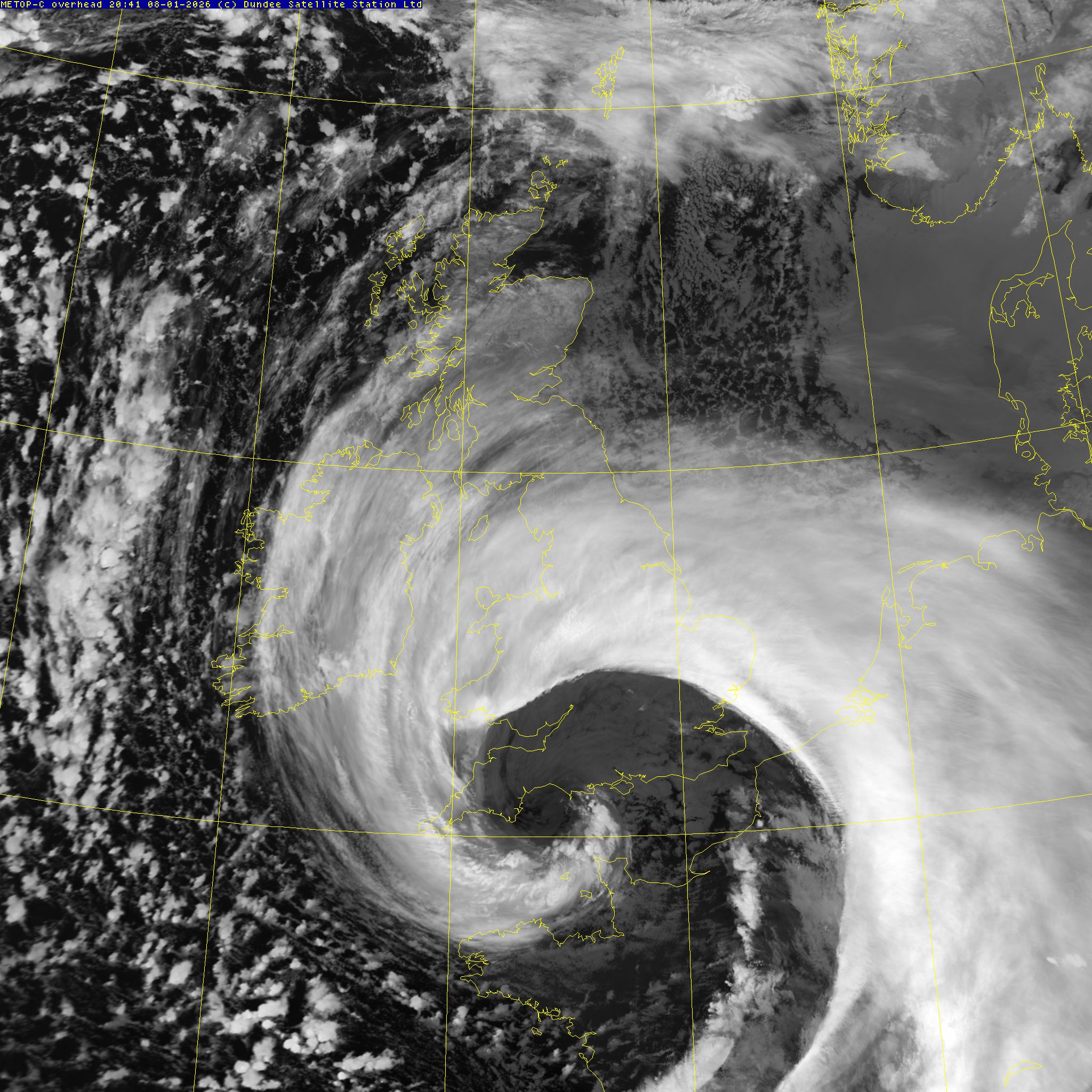
Storm Goretti (8 Jan 2026)
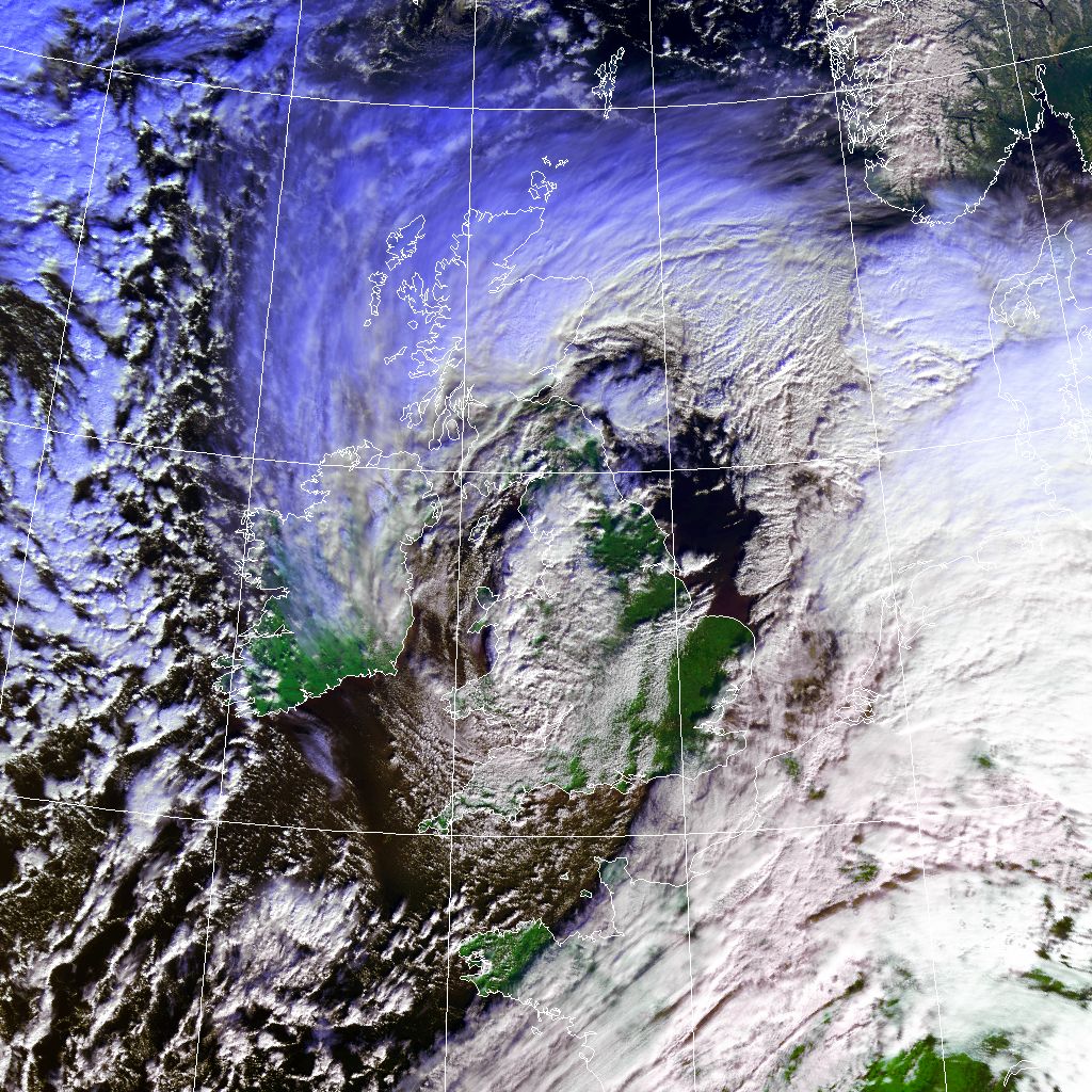
The good folks of the south-west of England had an unpleasant start to 2026 when the first named storm of the year hit with winds recorded to 99mph at St Mary's Airport (Isles of Scilly) and, unsurprisingly, considerable damage and disruption followed this. We captured this image overhead at 20:41 on the 8th Jan showing the eye of the deep low pressure system responsible for the winds.
![Storm Goretti 8 Jan 2026 Image of Storm Goretti showing low pressure over Cornwall]()
Site Expansion (16 Dec 2025)
Recently we have been supporting a new commercial client who needed a similar Earth Observation ground station to our Errol facility, but further north. Thurso is about as far north as you get before the Scottish islands of Orkney or Shetland. While those islands are fascinating places to visit, they come with a lot of cost, logistical, and utility reliability issues due to the more extreme weather and use of undersea cables. As a result we proposed staying on the UK mainland for a new site near Thurso (in fact we investigated 4 sites in the Caithness region around Thurso) and our client agreed with this.
Following a year of construction work done by Gow Groundworks to a high standard and on time (not so common for civil engineering works) we are at the point of setting up equipment there. In support of the operations of this facility in the future we are now looking to employ a few local trachnical staff and now have a page for the job opportunities.
We hope to be recruiting early in 2026.
End of the TIROS-N era (19 Aug 2025)
TIROS-N was the first digital polar-orbiting weather (Earth Observation) satellite. It was launched in October 1978 and carried the first generation of the AVHRR scanning radiometers to view the Earth in multiple spectral bands, both visible (reflected sunlight) and infrared (radiated heat). It boasted 10-bit resolution, something that few digital cameras had until decades later, and allowed the land and sea temperature to be observed with roughly 0.1°C resolution.
Peter Baylis and Dr. John Brush, founders of the Dundee Satellite Receiving Station (DSRS) at the University of Dundee, had been receiving data from the previous analogue generation of satellite and we well prepared for this development using equipment of their own design and construction. The first archived pass was overhead of Dundee at 13:45 on 6th Nov 1978 and is shown here:![First archived TIROS-N Image First archived pass of TIROS-N in false colour]()
The unsightly streaks across the images are due to data corruption when the original 14-track reel-to-reel tapes were transcribed to another tape format long after they ought to have been copied, due to limited funds for data preservation. Otherwise it is a good image of the UK in winter.
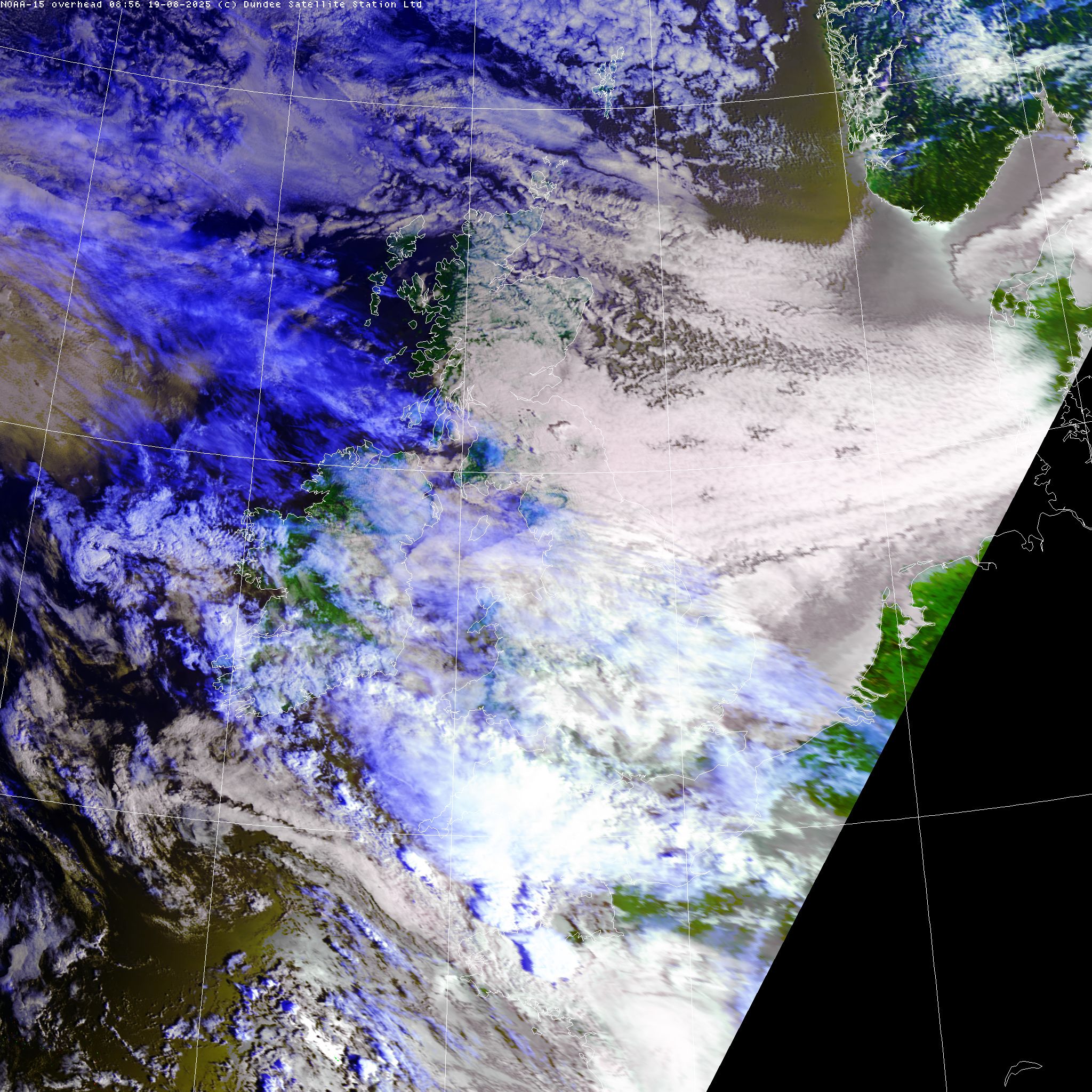
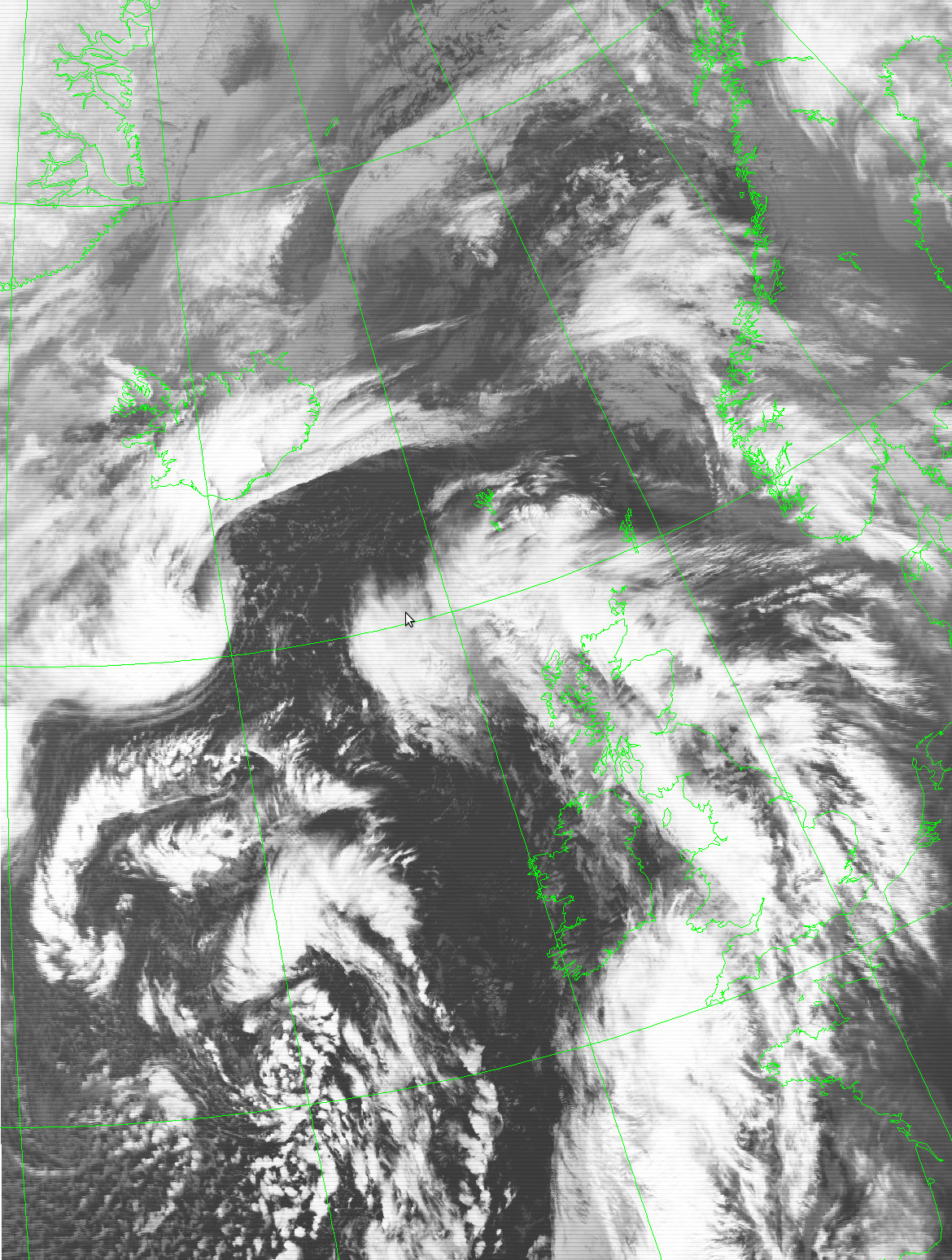
Following the decommissioning of NOAA-18 on 6th June, NOAA decommissioned NOAA-19 on 13th August (earlier than planned following a battery fault), and today it decommissioned NOAA-15 (later than planned). NOAA-15 carried the first of the 3rd generation AVHRR scanners and had an uncommonly long operational life of over 27 years and 141854 orbits of the Earth! As a compliment to the very first archived pass of the TIROS-N series of spacecraft above, below is the last UK-covering image of that satellite series from 08:56 UTC today:
![Last NOAA-15 UK Image Last UK pass of NOAA-15 in false colour]()
Overall this series of spacecraft have observed the Earth for almost 47 years providing a unique source of consistent high–quality data unmatched by any other. While the American TIROS-N series has now come to an end, the AVHRR still flies on for just now on the first generation of European polar spacecraft: METOP-B and METOP-C. Both METOPs are now beyond their design life but functioning well, so will the AVHRR live to see a 50th birthday?
NOAA-18 Final Image (6 Jun 2025)
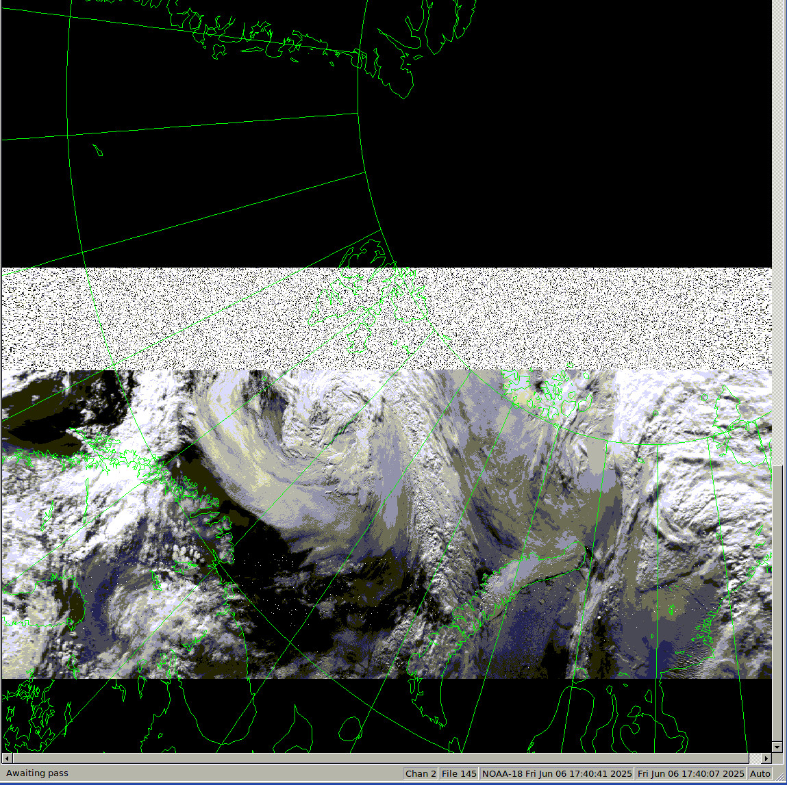
Sadly NOAA decided to decommission the NOAA-18 satellite after 20 years of service due to problems with the S-band transmitter used for both TT&C support and playback of onboard recorded data. We received the final pass on our 'Oscar' antenna and it shows the broadcast of HRPT data end abruptly at 17:40:07 UTC on Friday 6th June 2025. The AVHRR scan mirror was still spinning and generating nominal imagery after close to 3.8 billion rotations!
Below is a screen shot of the real-time display software showing this final pass:
![Final NOAA-18 image Quicklook image of the final pass of NOAA-18]()
The start of the pass was at 17:37:37 UTC with the antenna elevation of 1.6° and shortly after the satellite overflew just south of the Russian island of Novaya Zemlya and was heading towards the Norwegian archipelago of Svalbard but the transmission ended abruptly before it reach there. This was almost mid-pass with our antenna at 4.1° elevation. After that you see just noise for a while until the ingest software decided it was over. Had the imagery continued it would have reached the north-east of the Danish autonomous territory of Greenland
Year End Statistics (2 Jan 2025)
We operate an external host tracking system to check on site operations and at the end of 2024 the reported uptime of our 3.7m antenna was 99.96%, with the majority of downtime due to 3rd party network outages over the year. Of course a general policy of "no monkeying with a working system" has also helped there!
Permanent Fence and Site 'Completion' (13 Dec 2024)
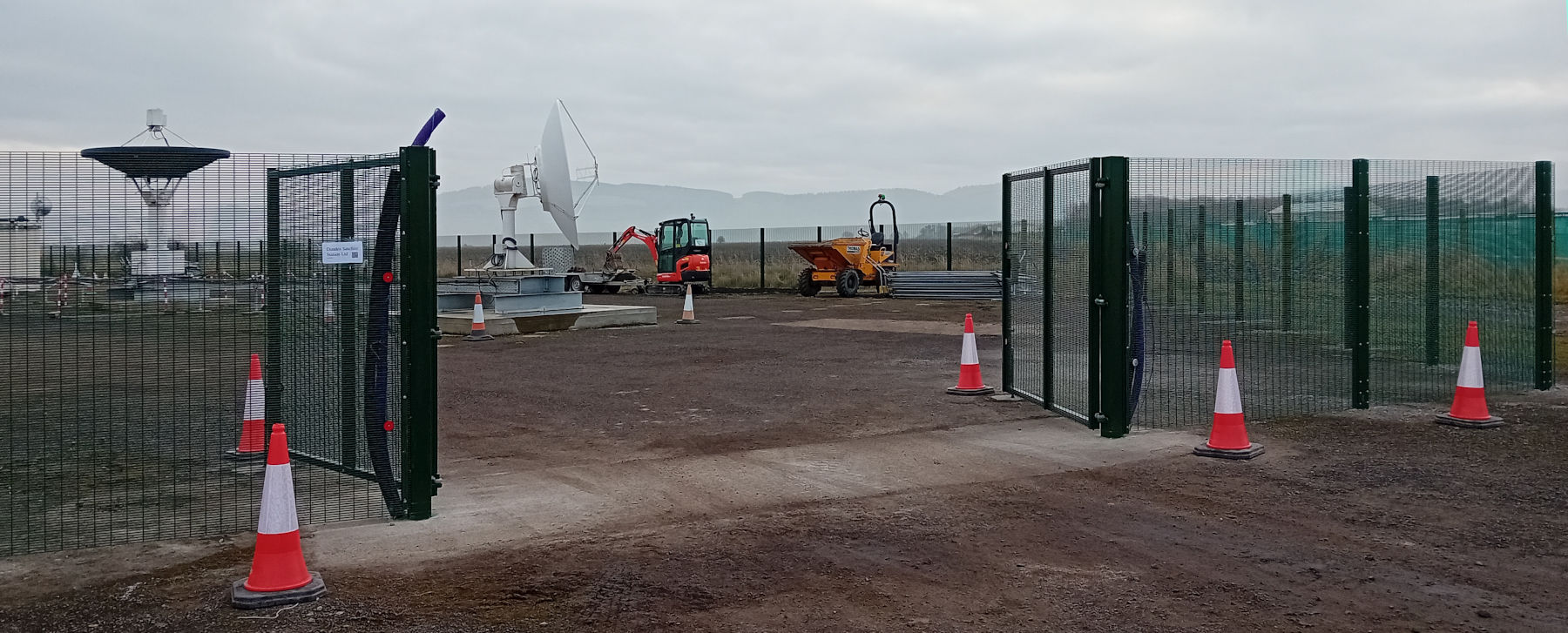
As part of our on-going task of completing our site we now have a permanent fence in place of the previous temporary fencing. The chosen fence type is a tough galvanized mesh with green coating to blend in better with our rural environment, while providing acceptable security and protection for the public outside when we are transmitting at high power levels inside.
![Security Fence Photo of our entrance gate showing the fence]()
Once we had selected the type of fence as one made by CLD Systems, they in turn suggested some certified installation contractors and based on the quotations and local reputation we went with Lechkin Fencing Services Ltd. They are relatively local to our Errol site (based in Comrie) and we have been impressed by their work, the job has proceeded quickly and the resulting installation looks very professional.
This permanent fence completes the original planning application's scope of work and so we are now 'finished' in that sense, however, we still have some way to go in other areas such as greater access to EO imagery and to get more involved in the R&D side of things we did at our previous university location. Also obvious in the above photo we have some tidying to do and cables to sort out! But for now it is good to see this stage completed in time for Xmas and before the 5th anniversary of planning permission.
DSS 5th Birthday (24 Jul 2024)
Looking back on the last year it has, alas, been one with little to actually show for our work in spite of various projects progressing or proposals being discussed. Perhaps the best news was our accountant telling us we have to pay corporation tax. Now most folk would not immediately see this as good news but it means we have finally reached the point of being profitable, something that is less common that you might hope for among the new space industry.
The American statesman Benjamin Franklin is often attributed with the expression "nothing can be said to be certain, except death and taxes", we prefer the taxes for obvious reasons, as well as paying for the things that any decent civilisation expects such as health care, education, police, defence, etc.
Election Day (4 Jul 2024)
Today is the general election in the UK, as well as a day of celebration for our American cousins. It is important for everyone to vote, even if they feel they are left choosing the least‑worst candidate. After all, if you don't vote you might end up with the worst candidate!
Cabin Progress (25 Mar 2024)
Not much in the way of visible activities at our site recently, the bright orange test cabin is now with power and networking ready for use, and we have put the spare antenna positioner next to it for test support. Eventually that antenna might be brought back in to EO data support, but for now it lacks the related reception and processing side of things.
Weather Station New Sensor (10 Jan 2024)
Just as we started the new year the outdoor temperature and humidity sensor in our Davis weather station failed, filling our log files with messages and more obviously not showing the outdoor conditions! A new sensor was ordered and has now been fitted, hopefully this will also fix the error in humidity where it never showed above around 70% RH even when thick fog. However, there has been a spurious rainfall reading during the fitting process (around 15:00) as the tipping‑cup rain gauge flapped around.
Round-Up of 2023 (31 Dec 2023)
Looking back at 2023 from a company point of view it has largely been "business as usual" in terms of site activities. Antennas were maintained, computers patched, and the backup generator given its first service (oil & filter change). We had hoped that the world would have less trouble after 2022, but sadly that has proven to be anything but better, and the mood at the Space Expo in Bremen this November was somewhat muted, even though there were more stands showing off innovative products.
Looking forward to 2024 we hope to further our R&D connections and support for clients looking for hosting of remote sensing capabilities. With any luck the long-delayed archive of data from our old DSRS days might just become available once more! In all cases, we wish a very Happy New Year to all of the folks who have supported us so far.
Experimental Cabin Arrives (16 Oct 2023)
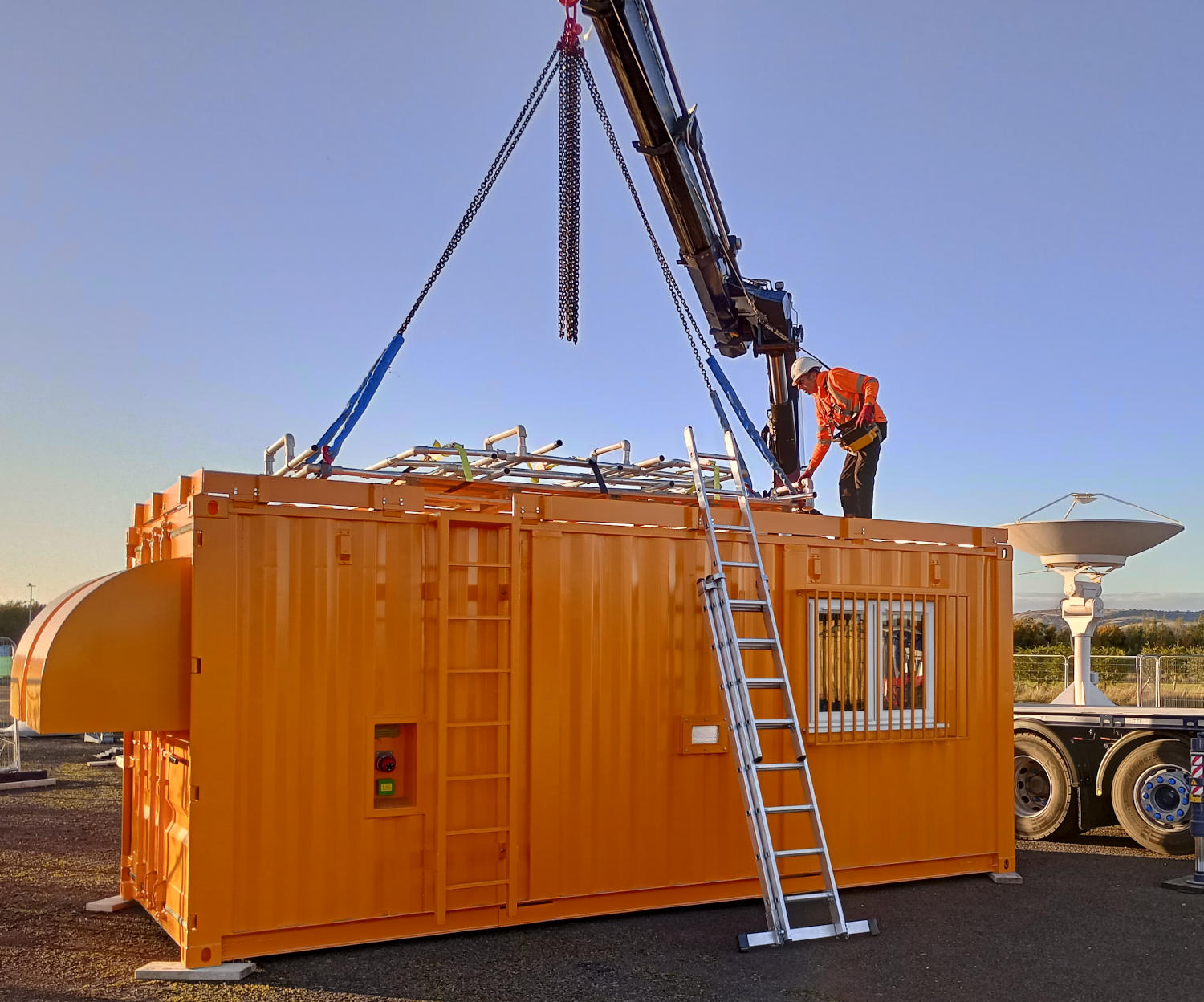
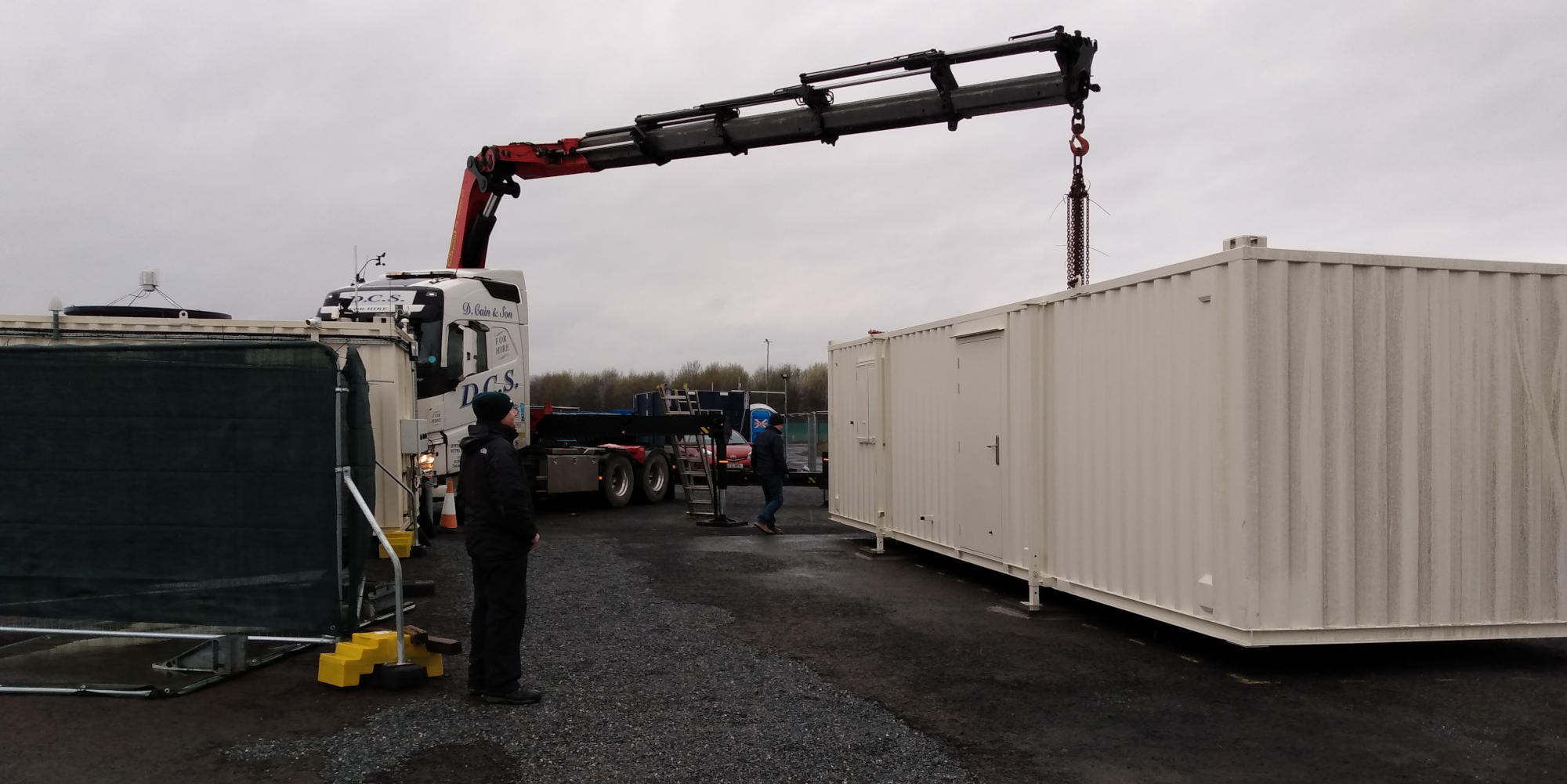
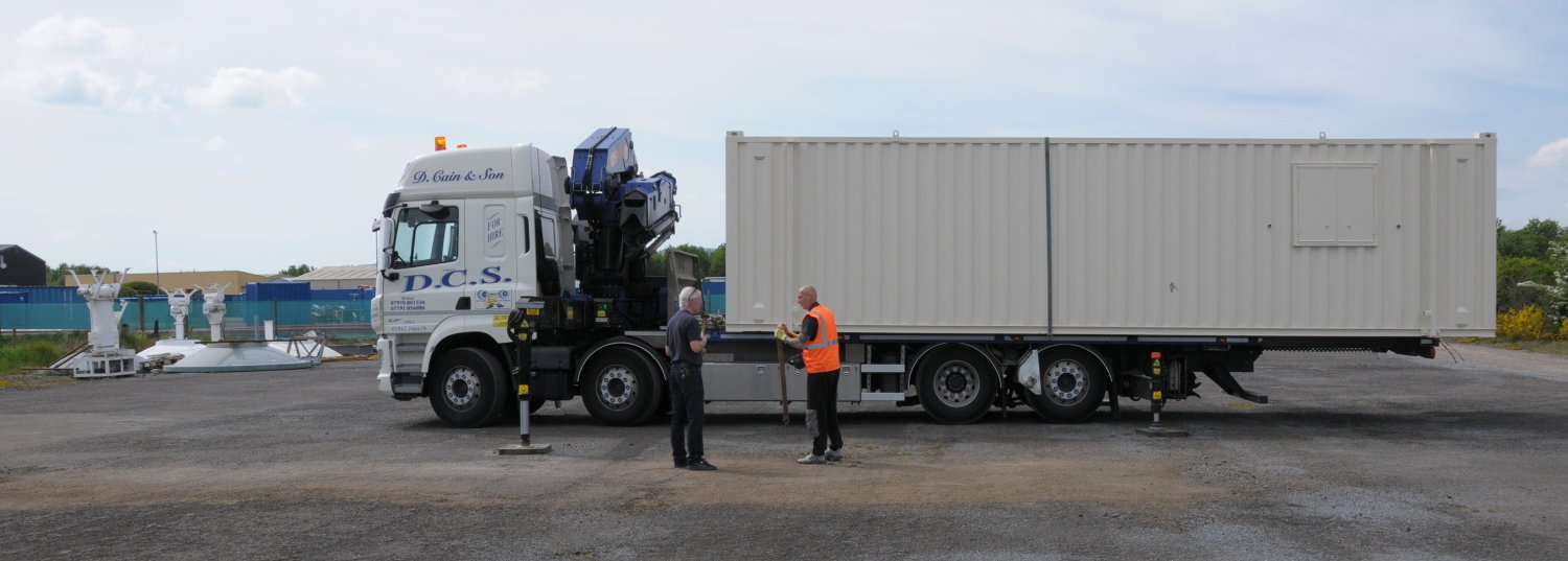
Today we took delivery of a cabin on behalf of a partner organisation that is working on new antenna designs. The cabin will house the supporting equipment to allow antenna testing, and ultimately to make it "portable" enough to be deployed to Arctic sites for further testing. The large hood-like extensions shown to the left are to keep snow off the air vents, not such a common problem here.
![Guest Equipment Cabin Photo showing bright orange cabin being delivered by Hiab truck]()
HOGS Project Cancelled (28 Aug 2023)
A year and a half on from the decision to locate the quantum telescope at our Errol site due to its low levels of light pollution and related radio support, we have finally been told by Heriot-Watt University that they are no longer proceeding with this arrangement.
This is disappointing news but not entirely unexpected. We wish the project team well for their alternative arrangements.
DSS 4th Birthday (24 Jul 2023)
Looking back on the last year we don't seem to have much to actually show in this blog. While there have been various system upgrades and changes made to make the site more reliable and resilient, those do not really make for good publicity photos. We have been moving/replacing/adding cabins in anticipation of the HOGS telescope project, but on that particular project front we are waiting for progress elsewhere.
What we have achieved recently is the refurbishment of our 5th tracking antenna pedestal. Currently it is under test without any reflector just to prove the motors, gearboxes, and position sensors are all working reliably. Quite what we will do with the antenna is still being debated, possibly it will be set up at our Errol site, but maybe at another Scottish site to give us country‑wide resilience.
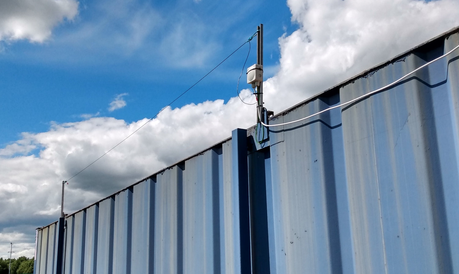
Longer Wire Antenna (8 Jun 2023)
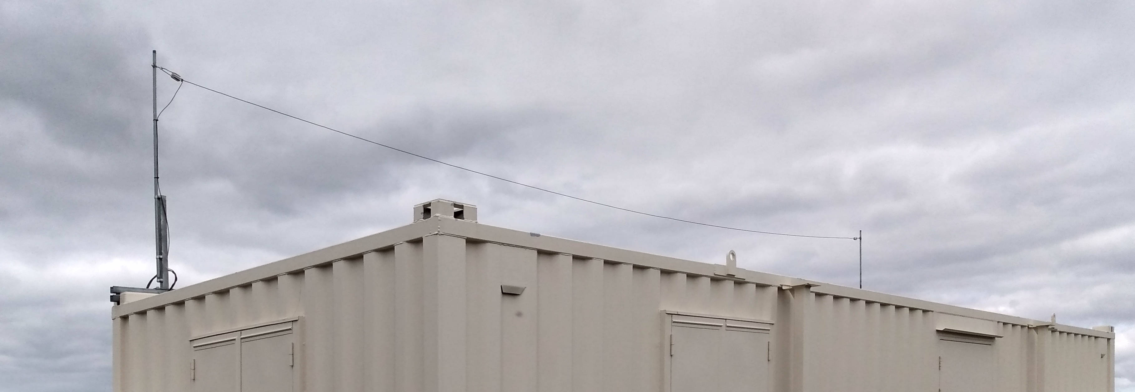
Eventually the new cabin will be our main on-site office and work location so a minor job was to add a long wire antenna so the MW radio can be used inside. This one is longer, higher, and capable of supporting more migrating swallows than the one on our temporary cabin. With any luck it will also improve reception of one of the sports stations that recently closed AM operation in the Dundee area.
We were able to get high-quality ceramic egg insulators from Ceramic Substrates & Components Ltd in order to support the wire. Still to do is the impedance matching transformer and related lightning surge protection in order to bring the signal inside the cabin safely and efficiently using 50 ohm coaxial cable to match the professional radio we have (Lowe HF150, see also our earlier blog from 21 Jun 2021).
![Long wire antenna Photo showing the new longer wire antenna mounted on the roof of the new cabin]()
New Cabin Power (10 May 2023)
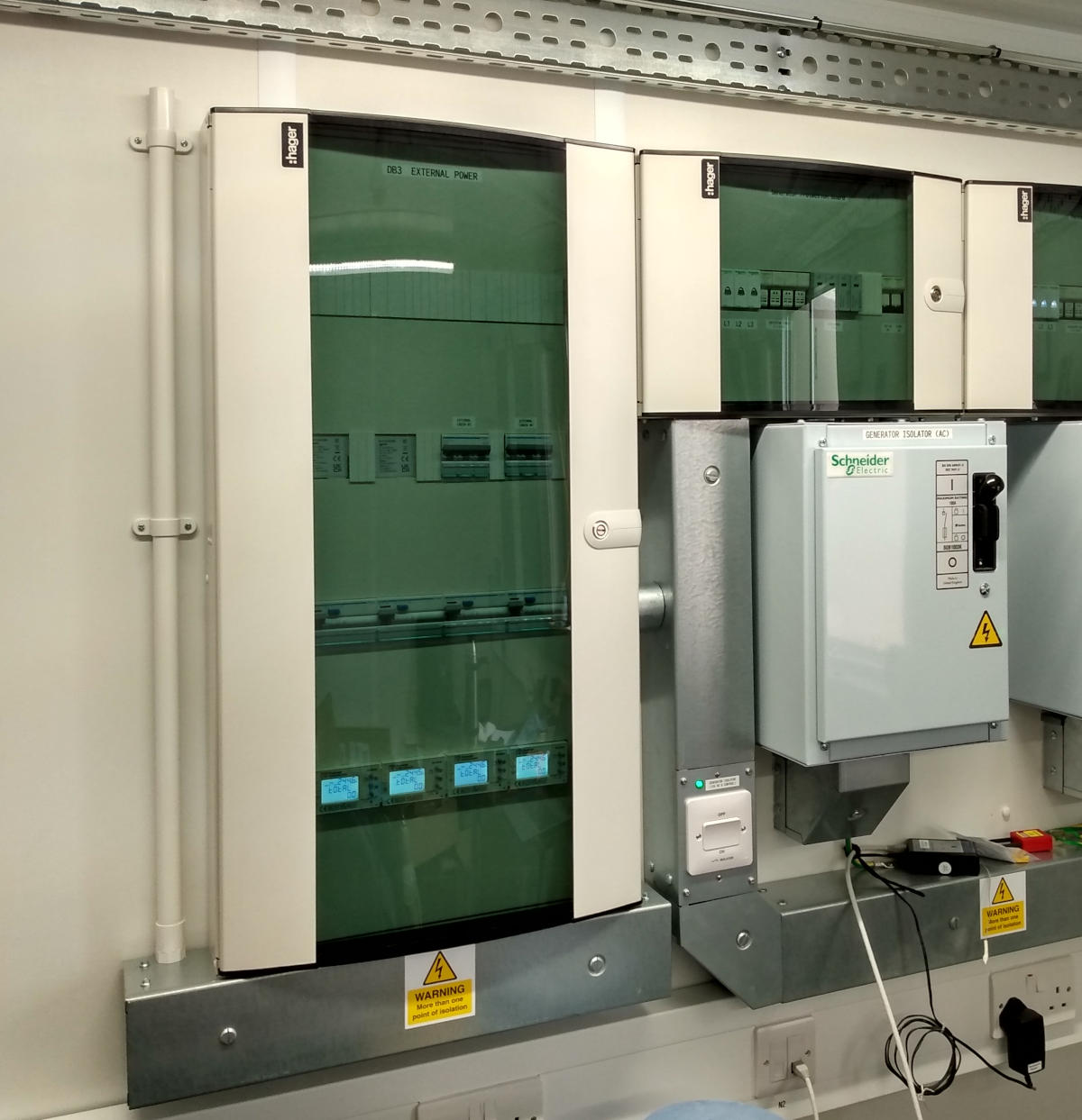
Following the delivery of our new cabin we have started on the arrangement to power it as time permits. This will also support the HOGS telescope and others in the near future. Of course when we first designed the site in 2020 we did not anticipate the interest from 3rd parties for collocation support so while the electrical supply arrangements had spare capacity, they did not have any metering or specific protection arrangements.
To address this we have added another distribution board to offer four external supplies, two are mains-only to limit demands on our backup generator, while the other two are generator-backed for cabins with known load profiles. They all have billing meters, including our own cabin, for dealing with the financial aspects. In addition these Rayleigh RI-D340 meters also allow you to check the per-phase current and other parameters of interest to ensure everything is working within the design envelope for system-wide reliability. Not installed yet are the fibre networking arrangements (the purpose of the white conduit on the left).
![New cabin power board on the left Photo showing the additional distribution board with 4 power meters to the left of existing power incomers]()
New Workshop Cabin (28 Mar 2023)
Our new cabin for use as a workshop and occasional site office was delivered today, significantly in advance of the predicted manufacturing time. Friday past we had cemented down some paving slabs for the support legs to have a strong and level platform and today we were relieved to find that all were in the right position! There is still much work to do in terms of wiring in power and networking to the cabin, as well as transferring most of the shelves and equipment from the other cabins to their final positions on site, but we can look forward to a more efficient site operation by the summer.
![New workshop cabin for Errol Photo showing the delivery of the new site cabin just as the HIAB crane was withdrawn]()
Cabin Solitaire (10 Mar 2023)
Not much to report for the first quarter of 2023 but in preparation for the HOGS telescope, which we hope will begin some time soon (or at least this year), we have cleared the area of our original hired cabin.
Of course that was full of our stuff for working on the site so we ultimately need our own workshop cabin. That is currently on order but won't be delivered until early May so we have another hired cabin in the interim period. Once we get our own cabin fitted out as desired we can move the stuff a 2nd time to free up the new hired cabin!
Round-Up of 2022 (31 Dec 2022)
If we had to sum up 2022 in two (polite) words it probably would be 'turbulent' and 'slow'. To say that the 2022 was turbulent is an understatement when we look at the damage unleashed most acutely by various authoritarian governments' actions, but also by other populist politician's hubris. While the impact of that is felt most immediately by the people on the receiving end of invasions and political oppression, the consequences are also are felt world-wide in some way by everyone.
As a result of these trouble times we took various steps to improve our security in the most general sense, not just enhancements to the site's physical and cyber protection, but also in terms of networking and power redundancy. One project that was competed in 2022 that had a major impact on this was the eventual appearance of fibre broadband to our site. That was SLOW. So slow in fact we computed that a garden snail could have made the journey from our Errol site to the Dundee data centre in less time that Openreach took to install the fibre! But once in place it offered an order of magnitude increase in speed over the previous microwave link, and that is now our fall-back option for network redundancy in the unlikely event of a fibre failure.
Relating to security of operations we also took steps to replace an older UPS and to arrange for backup generation, even though our electrical supply has so far proven to be very reliable. We had wired the site from the start to support automatic transfer to a generator but only in late 2022 did the risk of blackouts force us to divert our resources to this in preference, unfortunately, to other project goals. Here the on-going supply chain issues from both COVID-19, as well as high demand (as many other businesses having the same thoughts), made it impossible to get a custom-built generator to suit our needs in any reasonable time-scale since the delivery of new engines was quoted as 8-12 weeks by the two companies we contacted. However, the folks at one of those companies (Stephill Generators) had one of their standard units in stock and were willing to modify it for our non-standard use at minimal cost. We were impressed by their technical support and were able to take delivery within a week!
Another project that finally reached a decision during 2022 was the HOGS (Hub Optical Ground Station) in partnership with Heriot-Watt University to deploy a telescope and laser system, along with quantum detectors, at our Errol site to work along side our existing RF support. Along with HOGS we also have another couple of other projects under discussion, but all are taking so long at the administrative/legal stages that by the end of 2022 nothing physical has actually happened with any of them.
In terms of the DSS operations we are close to completing the refurbishment of our 5th 2.8m tracking antenna. Part of the HOGS planning permission update was to include the option for that on the Errol site, but exactly where it finally ends up will depend on what various partners want from Errol, along with some interest in having such an antenna at some other Scottish location. In addition to getting the antenna in to service again we are also looking at options to upgrade it for Ka-band operation or multi-band depending on what various clients are needed.
Looking forward to 2023 and beyond we obviously hope to see the various projects being discussed to come to fruition, as well as to look at a bigger antenna for Errol and to make progress on resurrecting more of the EO services we used to provide. We hope to get the old storage system back from the University of Dundee when they complete their duty to archive it (we did mention things being slow?) and then we can look at various ideas for using this academically (student projects, R&D collaboration) as well as various other options to deliver both free and commercial services.
Bremen Space Expo (17 Nov 2022)
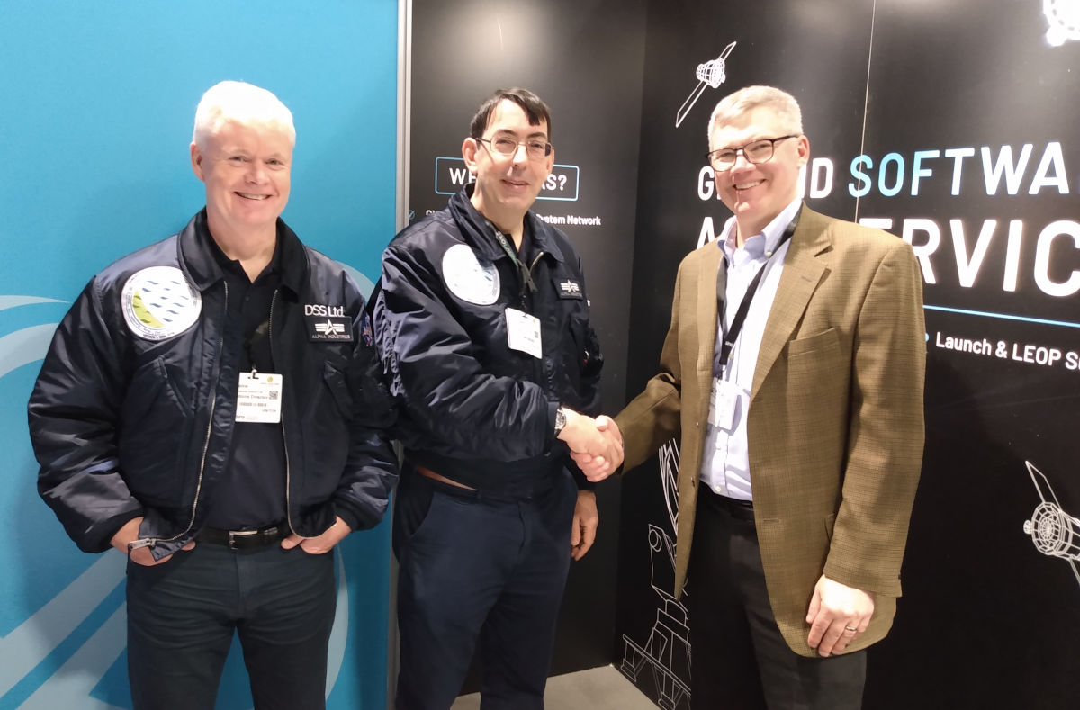
This year we decided to visit the Space Tech Expo Europe 2022 event in Bremen, Germany. This let us meet up with existing clients as well as potential new customers and suppliers from around the world. Will it be worthwhile? We don't know yet, but hopefully in the coming weeks we will see some positive outcomes. One meeting of special note was to get a chance to meet some of the folks from ATLAS Space Operations with whom we have worked with for a couple of years but never actually met:
![Meeting Matthew Schmidt of ATLAS Photo showing Neil & Paul meeting Matthew Schmidt of ATLAS Space Operations]()
Training BAS Staff (04 Oct 2022)
A long time ago in 1992 we built a weather satellite reception system for the British Antarctic Survey (BAS) for an atmospheric science experiment known as "Project ARIES". In itself that was a success over a couple of years with major contributions to the discovery and analysis of the hole in the ozone layer. However, ARIES timely delivery of good quality visible and infrared imagery rapidly became an operational service for the base at Rothera to help forecast the weather for the air strip and for various field party's safety. So much so that 30 years later, 3 generations of computers on, and long after the original science goals were achieved, it is still a valuable asset for the base!
DSS continues to provide support to BAS for system and on the 4th October we had 3 of the staff heading south this season up to our Errol site to provide some training in the operation and maintenance of the system. Our 2.4m antenna #3 is very similar to the ARIES system, except for the addition of Yagi antennas in Errol for small satellite support and not having the radome that is essential in Antarctica for protection against the weather (both for the antenna and for any staff working on it at any time).
New Nagios Server Running (05 Aug 2022)
A new Dell R250 rack mount server has become our 4th generation nagios machine, replacing a decade–old R200 that had done different jobs before it became the 3rd incarnation of the nagios server for DSRS in 2017. That in turn replaced a compact PC running Ubuntu 10.04 that was our 2nd server in 2010, which in turn had replaced an even older tower PC running Mandriva Linux from the early 2000s that was our 1st nagios machine.
The nagios software has the important but unglamorous job of checking all of our other machines are running normally and to quickly alert us to any problems. As this is a fairly light load for the server it also does miscellaneous jobs such as email forwarding, syslog analysis, etc.
The obvious assumption when upgrading is you just transfer the setting across, but that is rarely a good idea!
The first hurdle is the version of nagios has been updated (to version 4, rather appropriately) and that changes a number of aspects in ways you really need to verify. But also the setup at Errol is very different to the old DSRS arrangement so it made some sense to go through the new configuration machine by machine until all seem to be doing what we want now and not necessarily what they did in the past.
DSS is 3 Years Old (24 Jul 2022)
As we reach our 3rd year we reflected on the progress made so far and plans for the future. This week also saw record UK temperatures with the Errol site seeing a new high of 31.6C serving as a timely reminder of the importance of Earth Observation data to help planning. The short summary of how we got to this point is:
• Mar 2019 Closure of DSRS at the University of Dundee
• Jul 2019 DSS Ltd formed to continue operations
• Nov 2019 Planning permission for Errol site submitted
• Feb 2020 Planning granted by Perth & Kinross Council
• Mar 2020 First COVID lock-down began, interrupting our work
• May 2020 DSS Ltd cabin wiring begins on-site
• Sep 2020 First image taken at Errol site from Terra satellite
• Dec 2020 2nd antenna in operation, microwave broadband delivered
• Jan 2021 The 'latest image' feature appears on our web site
• Feb 2021 Start large-scale commercial services
• Aug 2021 3rd antenna in operation
• Oct 2021 4th antenna in operation
• Dec 2021 Fibre route civil works completed by ourselves
• Mar 2022 Refurbishment of backup antenna commenced
• May 2022 Fibre broadband delivered
• Jun 2022 HOGS collaboration with Heriot-Watt announced
Looking forward we still have a lot of software/web-site work to do to restore some of the past services, and we also have a lot of physical work to do with respect to completing the site and supporting the HOGS project. We are also looking to develop further EO services and collaborative projects with both industry and academia.
HOGS Announcement (30 June 2022)
After a couple of months of news embargo we are now free to report that the DSS site at Errol in conjunction with Heriot-Watt University was selected for the Hub Optical Ground Station (HOGS). Various newspapers have reported on this, for example The Courier and The Herald, as well as excellent coverage on The Register. The project involves a 0.7m telescope and laser communications to a satellite as a technology demonstrator for secure quantum key distribution world-wide.
Fibre Broadband Operating (10 May 2022)
Our ISP completed the hand-over of the fibre circuit to us complete with identical IPv4 block to the previous microwave link. A quick check of the speed on a laptop using a wired connection showed impressive results with speeds above 480 Mbit/sec in both directions and a surprisingly low ping time of 3ms to the closest Ookla test server in Edinburgh.
![Speed Test Results Screen shot of Ookla broadband speed test]()
Fibre Broadband Almost There (06 May 2022)
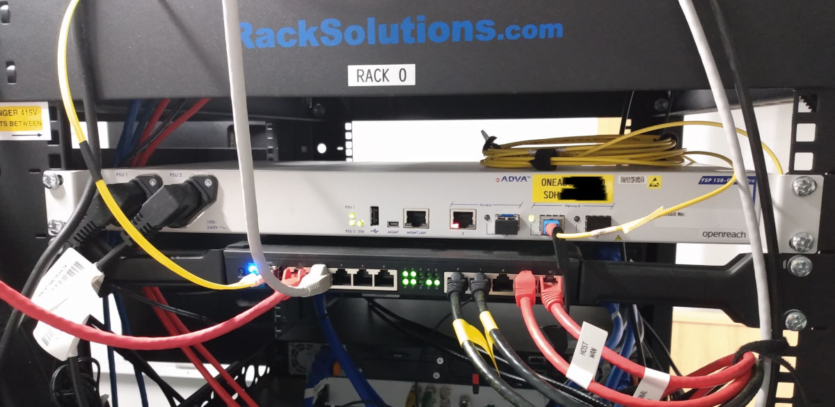
Well today we finally had the fibre optical circuit completed at the equipment powered up. We are still not there, it has to be commissioned by Openreach first then handed over to our ISP, but at least we have some signs of progress!
![Fibre Network Terminal Equipment Fibre NTE showing new fibre lit and ready for commissioning]()
Storm Eunice (18 Feb 2022)
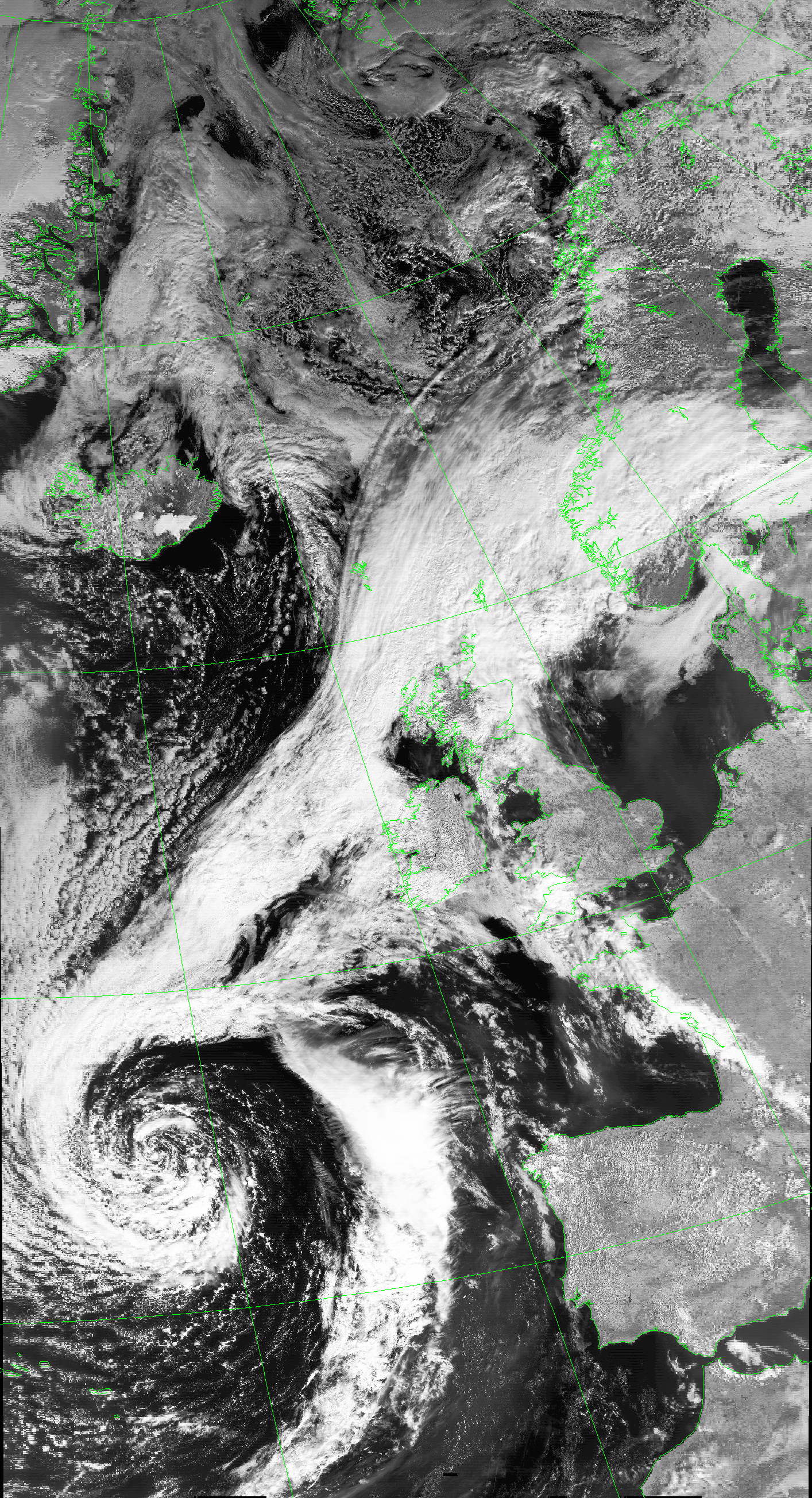
Unusually for the UK we had red danger warnings for the south of England during storm Eunice and with good reason: winds of 122mph were recorded and 3 people sadly died , as well as damage to power and communications. Again we were very fortunate to see little impact, just some wet snow and medium winds. Below is the image from METOP-C over the UK at 10:30 on Friday 18th showing the storm's progress with the clear strip over London looking benign but actually having seriously high wind speeds:
![Storm Eunice METOP-C image of UK during Storm Eunice]()
Fibre Broadband Approaching (09 Feb 2022)
These days having an Internet connection is a must, and it is hard really to imagine the time when it was rare or indeed non-existent. However, we do remember as the old DSRS existed before the invention of TCP/IP and the availability of the WWW! At that time computers were generally connected together by serial lines (typically RS232 or RS422) or by parallel bus systems of generally propitiatory nature. For example, for a few decades we supported data transfer in to our computers using the old DEC DR11W standard, later supported on Sun workstations and PCs via 3rd party cards. At this time we delivered data to end users either as photographic prints or by computer tape by post.
By late 1980s we were using a combination of Sun workstations and PCs network internally with the "yellow spaghetti" 10BASE2 network using coax cable which was less than ideal as both the network drivers for the DOS/Windows PCs were rather unstable, and also the CSMA/CD system dropped efficiency when busy and a cable fault anywhere took down the whole lot. Thankfully by the 1990s we were on 10BASE-T networking internally, using the twisted pair cables and switches, just as most would recognise today. While it meant a massive increase in cabling it was also far more stable and efficient, and we also had a connection to JANET (joint academic network) that gave us considerable (for the time) bandwidth to transfer data to user over the Internet. However, it was a few years before some of our users were able to handle the volumes of data delivered by satellite so tape and photographic products continued for many years.
By the 2000s we had all but stopped tape & photographic products and delivery by Internet was normal. However, we were in the luxurious position of having the upgraded JANET connection which provided amply low-latency bandwidth. When DSS Ltd set up at Errol it was a bit of a reality-check when it came to getting a connection outside of a big city. Basically, it sucks!
We only had one realistic choice to begin with, to get a microwave point-to-point link by the local ISP Fibrecast. They have proven to be excellent in service, but still a multi-hop microwave link has practical limitations that are difficult or impossible to overcome. First of those is bandwidth, as that is limited by the spectrum allocated and getting more can be absurdly expensive, second of those is latency as the data is routed around multiple hops (most delay in the equipment, not the light-time), and third is the impact of bad weather on the links (including equipment damage).
But now we are close to the end of the Sisyphean task of getting fibre to our premises to have sufficient speed for both our own plans for Earth Observation data and to satisfy what customers are requesting (such as 300Mbit symmetric). It has taken a total of 1.5 years and 3 orders (first two with another provider had to be cancelled as undeliverable in any realistic time-scale or cost, even the third had to be re-surveyed to get round way-leave permission problems) but we just had the fibre brought though the 0.5km of duct we installed ourselves. We are grateful to Fibrecast for the final success of the order for fibre with them!
What is surprising is how small a 12-way fibre cable is compared to the standard 96mm duct that Openreach and other telecom companies specify. But still there is a 50m or so overhead route to be installed to cross the public road, and the various fibres joined, so it will be a short time yet before we can test it and then migrate our network to use it.
Tonga Eruption (15 Jan 2022)
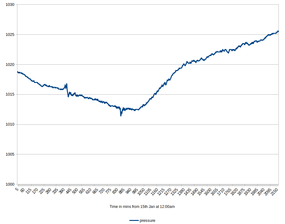
The 2022 Hunga Tonga eruption and tsunami caused terrible damage and loss of life to the pacific island. Unfortunately we did not collect the usual image data as direct broadcast is beyond our horizon and we have not yet resurrected the geostationary relay service we used to run. However, one of the founders of the original DSRS station, Dr. John Brush, has high time resolution recording of his own weather station and it shows the iconic pressure wave that traversed the Earth and reached the UK almost half a day after the main blast. Unfortunately our own weather station data is only recorded in 30 minute summaries, so that sort of detail was lost!
![Tonga volcano pressure wave Graph of atmospheric pressure showing two pressure waves from eruption]()
Round-Up of 2021 (31 Dec 2021)
Although we had the 3.7m and 2.4m Az/El antennas running by late 2020, it was 2021 that marks first year of any real operations at our new Errol site. During 2021 we resumed some live Earth Observation data generation and access to the site's weather station. We also completed the renovation of the two 2.8m X/Y antennas, but it was only at the very end of the year that we had 4 antennas all tracking again.
We had some extrema weather as well with the exceptionally cold day in Feb at -14C, but we were spared the worst of Storm Arwen with our site suffering only minor damage to fencing and flood lights and no operational interruptions. Also of note was the final image for METOP-A after its 3.5 billion km service life.
Looking forward in to 2022 we hope to finally get fibre broadband to the site by Feb which will help us and our clients with faster and more reliable data access, and to build on our capabilities with more RF, EO, and R&D projects. Restoring access to our archive of data is still on our to-do list, but we are finally seeing it become possible.
We wish all of our supporters and customers the very best for 2022!
Antenna #1 Sun Tracking (10 Dec 2021)
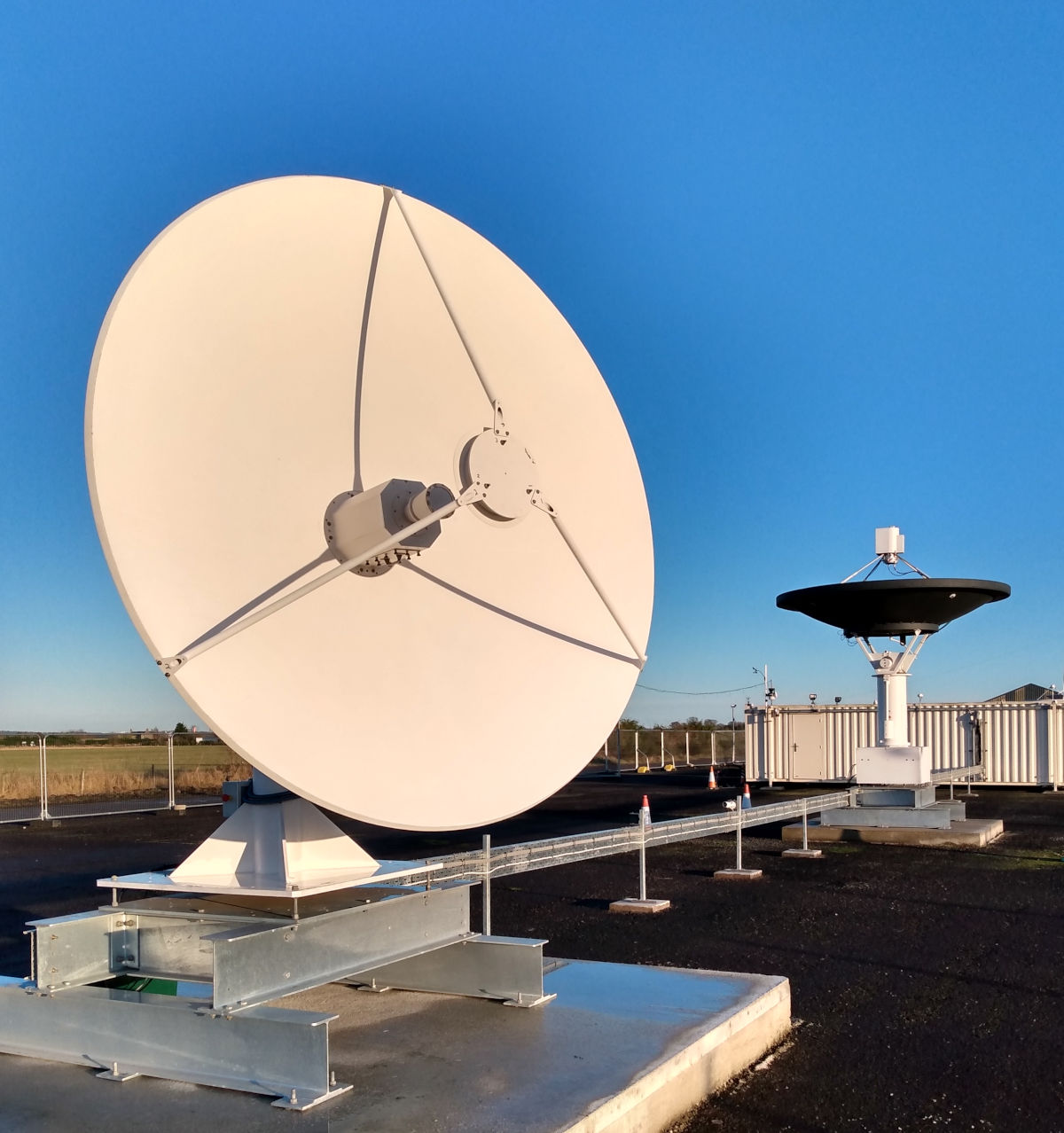
After many delays, largely due to other work taking priority, today we got the RF electronics connected up to Antenna #1 (currently a 2.8m X/Y mount) and started the process of calibration of its pointing direction using the Sun and the Moon as targets of accurately known position that produce a small but detectable level of radio noise. After the first calibration point it was sufficient to track NPP & Aqua to demonstrate the data ingest side is working, but it will take another 24 hours or so before we have sufficient points to accurately characterise the mount.
The photo below shows this along with the #2 antenna in the background. As we were fortunate to have a sunny day in December you can also see the shadow of the Cassegrain sub-reflector aligning with the feed.
![Antenna #1 Sun-track 2.8m antenna #1 tracking the sun with 3.7m antenna in background]()
Storm Arwen (26 Nov 2021)
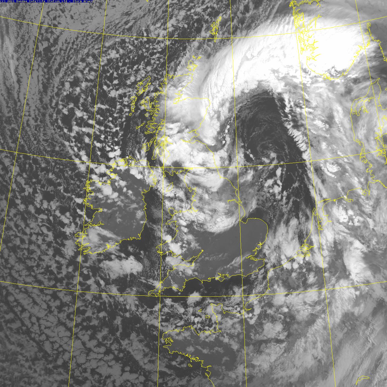
The UK, and in particular the north-east cost, was battered by storm Arwen on the evening of the 26th and through to the early morning of the 27th with wind gusts reached speeds of 98mph in Northumberland. This caused extensive damage and disruption to transport and electricity including the tragic deaths of 3 people.
Our site was spared the worst of this, we recorded a maximum of 51mph wind gust, but we still suffered minor damage to some temporary fencing and the very unpleasant overturning of the chemical toilet (which we will spare you the sight of). We did continue tracking without incident, though our UPS did note several power glitches, and we received several images of the storm, for example, this image from NOAA-19 over the UK at 18:30 on 26-11-2021:
![Storm Arwen CH4 infra-red image showing storm Arwen over UK from NOAA-19]()
Final pass from METOP-A (15 Nov 2021)
In our previous incarnation as DSRS we took the first pass of METOP with the AVHRR instrument running on the 25th Oct 2006 and when it became operational. Due to problems with the transmitter High Power Amplifier not being adequately radiation-hardened they decided to only use the L-band direct broadcast service on south-bound passes over Europe below 60N to speed delivery of the data, relying on the on-board recorder and X-band data dumps for the remaining services.
This resulted in no METOP-A operations over Antarctica. This was disappointing as we had upgraded the British Antarctic Survey's reception system at the Rothera base (build by us in 1992) with new computers and a receiver capable of METOP operation. Later the METOP-B and C would provide support in that region.
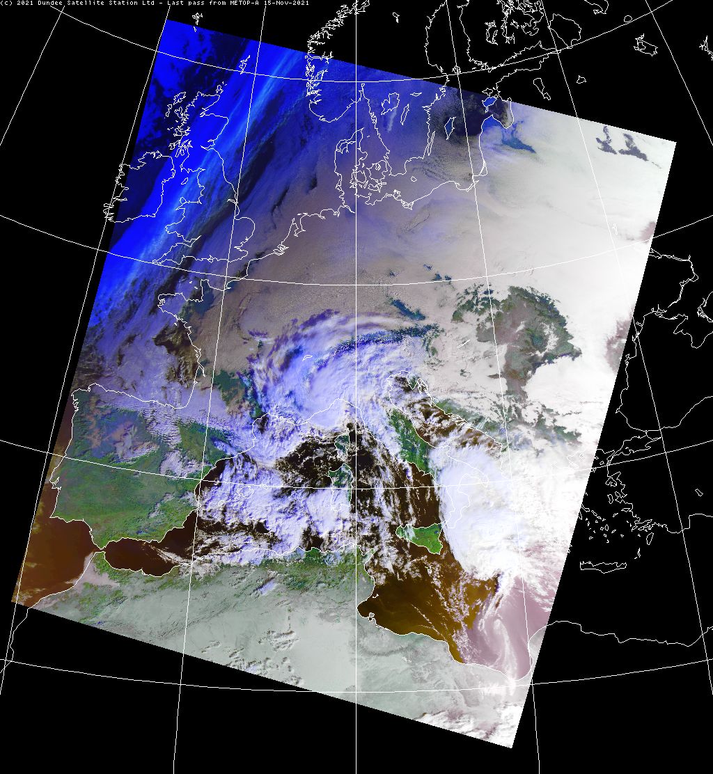
Eumetsat decided to decommission METOP-A so it could be responsibly de-orbited while it was still in a commandable state, so various systems have been shut down and today was the final day for direct broadcast of the AVHRR instrument. Below is a false-colour RGB composite (1k x 1k size) of its final pass, overhead (maximum elevation) of our site at Errol at 07:45:51 on 15-11-2021 after 78217 orbits of the Earth and having travelled around 3.5 billion km in its 15 year operational life. You can also get a larger 4k x 4k version to scroll around.
![Final METOP-A pass False colour RGB image from final pass of METOP-A over Europe]()
Fourth Antenna Lifted to Plinth (04 Nov 2021)
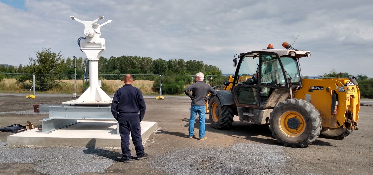
After some testing on the ground, the fourth antenna planned for our site was lifted on to the #1 plinth with the help of a local farmer's workman and a large telehandler. Again, we were really impressed by the skill and control he had over such a bulky machine!
Of course we still have the reflector and RF equipment to do, but it now means we have the four antennas planned for phase one of the site in their intended positions and wired for tracking operations. After further testing with the RF system in place we will be in a position to start using it, or modifying it for other use.
![4th antenna being lifted X/Y antenna mount lifted by telehandler]()
Fourth Antenna Under Test (14 Oct 2021)
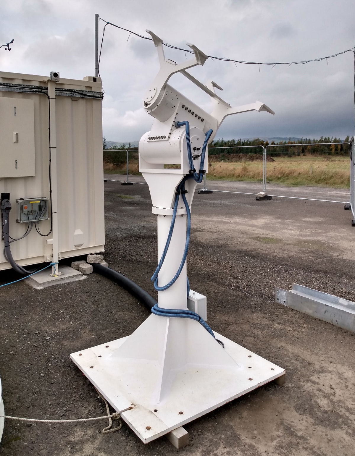
The 4th antenna planned for our site is now being tested for basic operational stability before we get it mounted on the final plinth. Hopefully we will be able to do that in the next week or two and then we can test it for real with the reflector and RF equipment reinstated.
Most likely this antenna will be modified after performance testing is completed so it better fits what we are seeing demand for, but that is a story for another time.
![4th antenna on test X/Y antenna mount on the ground being tested]()
Volcano on La Palma (23 Sep 2021)
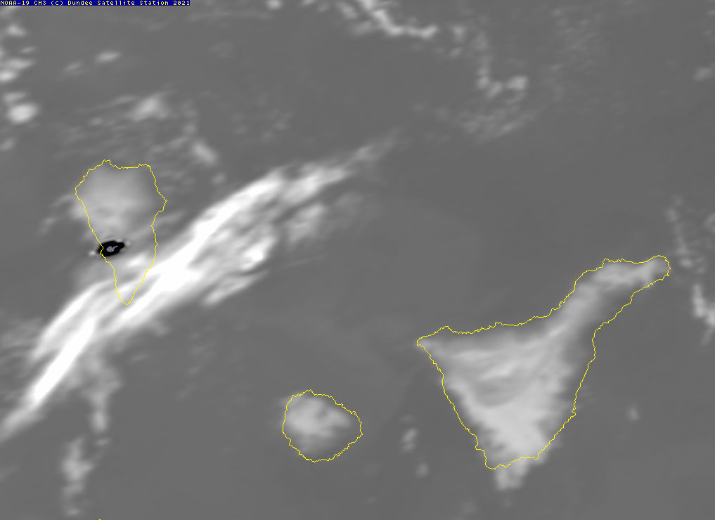
Our coverage area only just reaches the Canary Islands, but we noticed this image showing the heat of the volcanic eruption of Cumbre Vieja in the CH3 infra-red band of the AVHRR instrument. This was taken by the satellite NOAA-19 on 23 Sep 2021 with the satellite overhead of our Errol site at 19:28:42
It is a common convention that IR images are shown with black=hot and white=cold so clouds appear as white against the warmer background of the land and sea. Here the heat of the volcano is obvious as the darkest spot in the image. The AVHRR instrument has limited spatial resolution, around 1km at the sub-satellite point and a couple of km at this view, but makes up for it in radiometric resolution as it can resolve around 0.1C temperature differences.
![Volcano on LaPalma Hot sopt on CH3 from volcano on LaPalma island]()
Third Antenna Tracking (13 Aug 2021)
When the worst of the weather passed we were able to get the reflector, sub-reflector, and feed installed on the refurbished antenna on plinth #4 by the 12th and then some preliminary testing was done. On the 13th when this photo was taken we had successfully received X-band data from Terra, Aqua, NPP, and NOAA-20.
We still have some minor cleaning-up jobs to finish and the current cables are temporary ones made up from lengths of cable recovered from the old installation, so they also need replacement. However we are further down the road now towards expanding the range of Earth Observation data we can gather.
![Antenna on Plinth #4 tracking 3rd antenna with reflector tracking satellite]()
Antenna on Plinth #4 (05 Aug 2021)
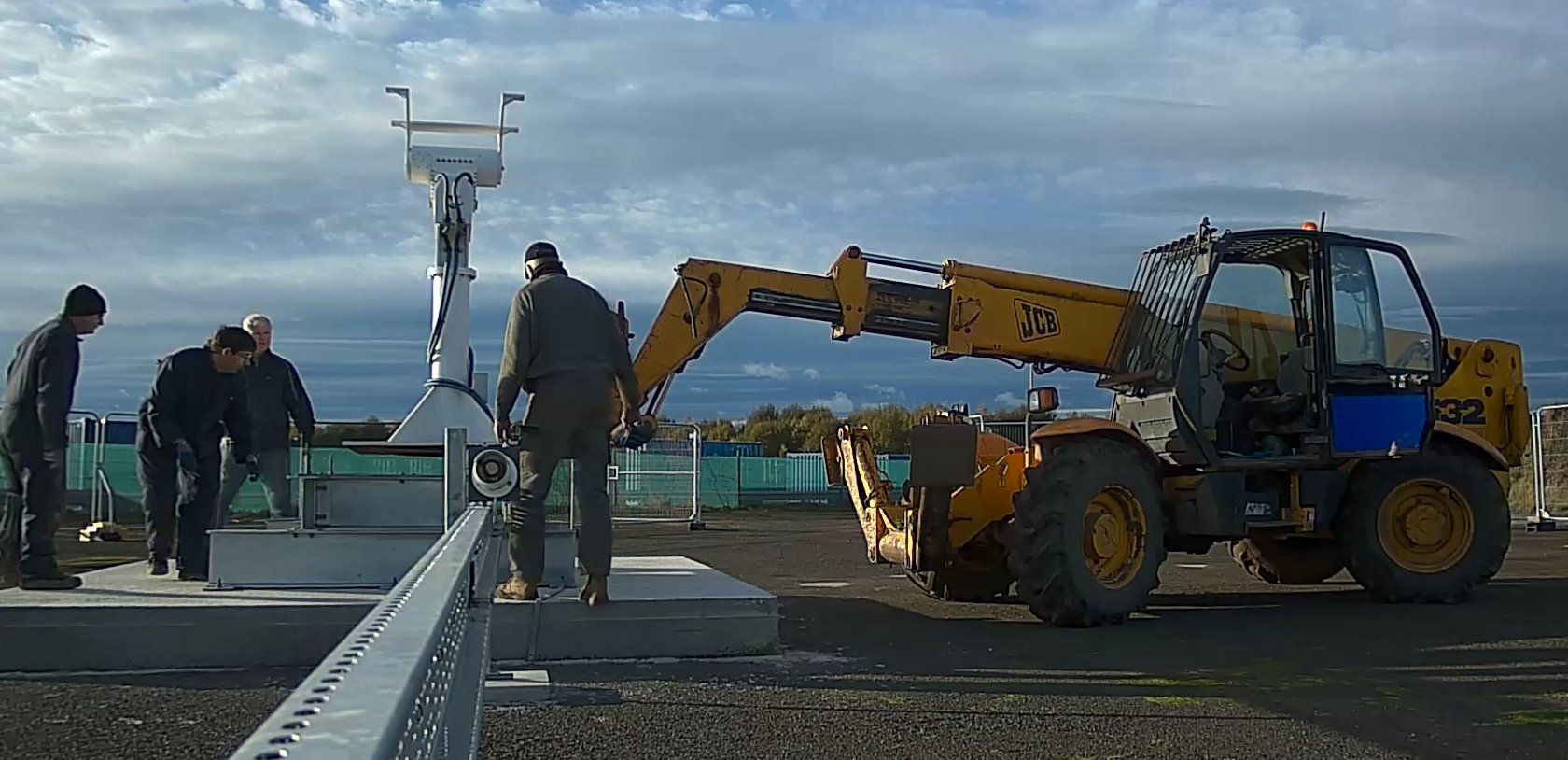
The newly refurbished X/Y mount has now been lifted on to the #4 plinth position with the help of a local farmer and his amazing skill in using the telehandler, bringing the total of antennas ready for real-world use to 3. We still have one more antenna to refurbish for this site which will end up on the #1 plinth location.
Before we can actually use it we also have to mount the 2.8m reflector and RF feed, as well as performing precise pointing calibration, but with any luck that can be done in the next week or so. While the weather was great for the actual lift today (shown below just after completion) we now have a thunder storm warning for Errol so further outdoor work may be halted for a while.
Once this antenna is running it will initially be tested on the X-band weather satellites. Longer term it is likely to continue with those duties to some degree or another. Generating images for our web site from this data hopefully will follow soon as we try to get the processing systems back in to operations once more and, as before, it is our intention that free access to many of these products will continue.
![Antenna on Plinth #4 Refurbished X/Y pedestal mounted on plinth and telehandler used to lift it]()
2nd Birthday (24 Jul 2021)
DSS Ltd has now existed for two years and during that time we have continued to work on the new facility at Errol and the wider process of bringing back access to the environmental data, both new and historical.
Currently we are assembling the 3rd antenna following its refurbishment and hope to have it operational within the next month, before moving on to the 4th antenna.
Long Wire Antenna (21 Jun 2021)
With the Euro 2020 football on after the year delay due to COVID-19 listening to it on a mobile phone in the laughable "loudspeaker mode" not going very well we decided to install a temporary AM antenna and break out of retirement a Lowe HF150 radio for decent reception on the MW bands (the radio covers 30kHz to 30MHz though).
The HF150 was a remarkably good radio for its price, the product of a talented designer (John Thorpe) and made in England in the 1990s. Sadly production stopped a decade later for a number of reasons (including Plessey stopping production of the SL6440 high linearity mixer IC) and interest in LW/MW/SW broadcast reception has plummeted over the last couple of decades due to internet access to news and music and very high levels of radio noise in built up areas (in spite of the EMC directive's goals).
Still, it is nice to hear the radio in use again and sound is remarkably good. You also hear the background cracking noise when there is a lot of lightning storms over Europe!
![Long Wire Antenna Long wire antenna mounted on temporary cabin]()
New Web Site (18 Jun 2021)
We now have a new-look web site with the help of Lance French.
False Colour Images (12 Jun 2021)
We now generate false colour composite RGB images from the AVHRR data in our Latest Images section. These make use of the two "visible" channels of reflected sunlight along with ones of the infra-red channels of radiated heat to provide a false colour representation of the Earth's surface. In this case it is the best that is practical as the AVHRR scanner lacks "true colour" (i.e. channels that match the human eye's perception of light) so the results always look a little strange.
Another issue with the false colour images is the behaviour at night time, as they are based on histogram equalised images, and at night the visible channels become a noisy grey plane, confusing the results. However, they are still a very convenient way of visualising multi-spectral data and using the human sensitivity to colour to highlight features of interest.
Hottest Day since Dec 2020 (04 Jun 2021)
Our weather station recorded 18.9°C, marginally beating the best since we put up the weather station in Dec 2020 which was 18.8°C on 18 March 2021.
The coldest remains -14.8°C on 11 Feb 2021.
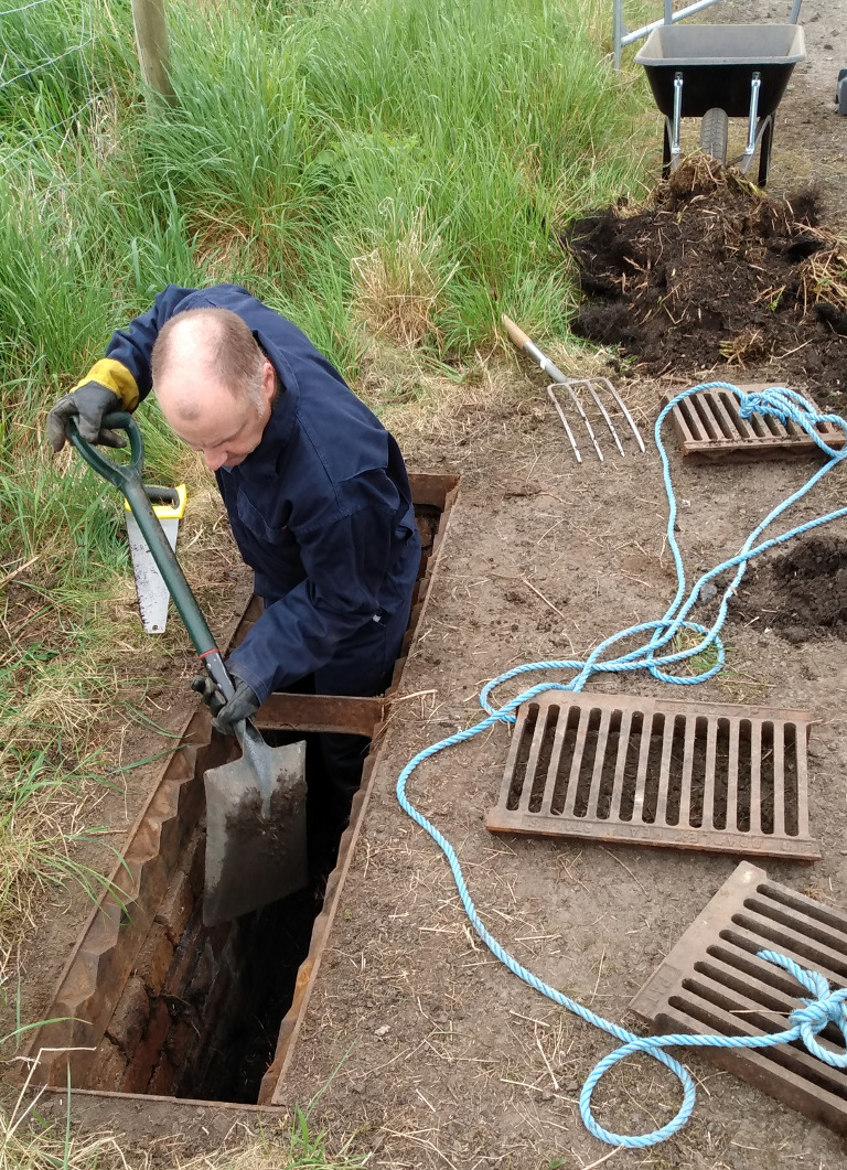
Clearing Storm Drains (31 May 2021)
When we were selecting the new site for DSS Ltd one aspect we checked was the flood risk using the maps provided by SEPA Unsurprisingly, the former RAF Errol site was not at risk as no doubt they performed due diligence during WW2 as well in selecting the location.
However, one can never assume that the climate is static and for operational reasons the base had good sized storm drains along both sides of the runways. As part of the preparation of the new high-tech space-age site site we had to get our hands dirty doing the first maintenance for 7 decades the old fashioned way with a spade and wheelbarrow to dump the accumulated mud and vegetation.
![Cleaning WW2 Drains Photo of work to clear the WW2 storm drains, shows man waist deep in one]()
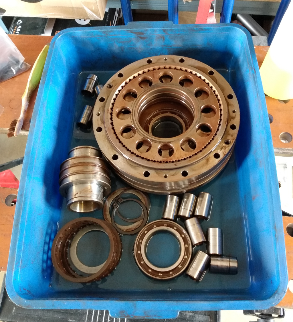
Gearbox Work (20 May 2021)
As part of the renovation of the remaining antennas we have stripped two of them down to clean and service them, replace flexing cables, etc. One aspect we wanted to do was servicing of the gearboxes as they have been sealed up for many years. Unfortunately for us, the company that used to supply the antenna drive trains was bought over in 2018 and gutted of the useful support they provided to us. The only option we seemed to have was to get the UK importer to ship them off for the work, adding to the overall time, cost and unnecessary risk. The antennas use a cycloidal final drive and the manufacturer advises against opening them and do not provide instructions to do this.
But how hard could it be?
We decided to have a go with one gearbox that was known to be worn and in need of replacement, so we dismantled it after buying some large bearing pullers. Here is the internal parts in their second bath of paraffin during the cleaning process:
![Cleaning Cycloidal Drive Photo of gearbox internals being cleaned in a bath of paraffin]()
Thankfully we worked out the trick to getting it all back together again with the three eccentrically driven disks in the right phase relationship. So next we will tackle the good gearboxes!
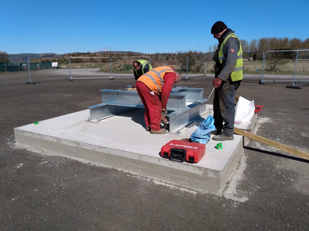
Installation of Steelworks (12 Apr 2021)
The installation of the steel support structure for the new antenna plinths by one of our local companies, Jackson Steel Structures Ltd of Dundee, was completed in April. These supports have mounting holes for all 3 types of antenna we had built for Dundee and allows us to swap them around as necessary.
![Installation of Steelworks Photo of the installation team working on the steel structure for #1 antenna plinth]()
Antenna Plinths poured (24 Mar 2021)
We had the concrete plinths for antennas #1 and #4 poured with the help of local builders and the concrete supplier also on the former RAF Errol airfield. We decided to make the #1 plinth larger so we can accommodate antennas up to 5m in the future and still survive 120mph wind speeds, without needing any modifications of the foundations.
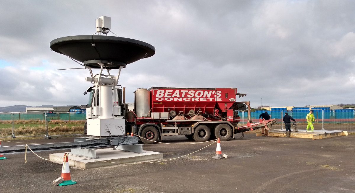
The image below shows this larger #1 plinth being poured along with the 3.7m antenna (#2) that is already in operation. It is planned these next two antennas will primary be for remote sensing / environmental monitoring.
![Pouring Antenna #1 plinth Photo of the concrete truck pouring into the shuttering for #1 antenna plinth]()
Remote Sensing Images (30 Jan 2021) and Weather (08 Feb 2021)
We are now producing some Latest Images from the weather satellites that are updated automatically. For now this free and open service is only providing the UK "overhead" images from the NOAA and METOP series of satellites carrying the AVHRR instrument, but we hope to extend the coverage and range of image data soon.
The site also has a local weather station that normally updates every half hour. User Ctrl+R to refresh if needed.
NOTE: The weather station equipment is not mounted according to the official requirements for wind measurement height (10m / 33 feet), or distance from tarmac for temperature, so we cannot guarantee the accuracy.
First Overhead Pass of 2021 (01 Jan 2021)
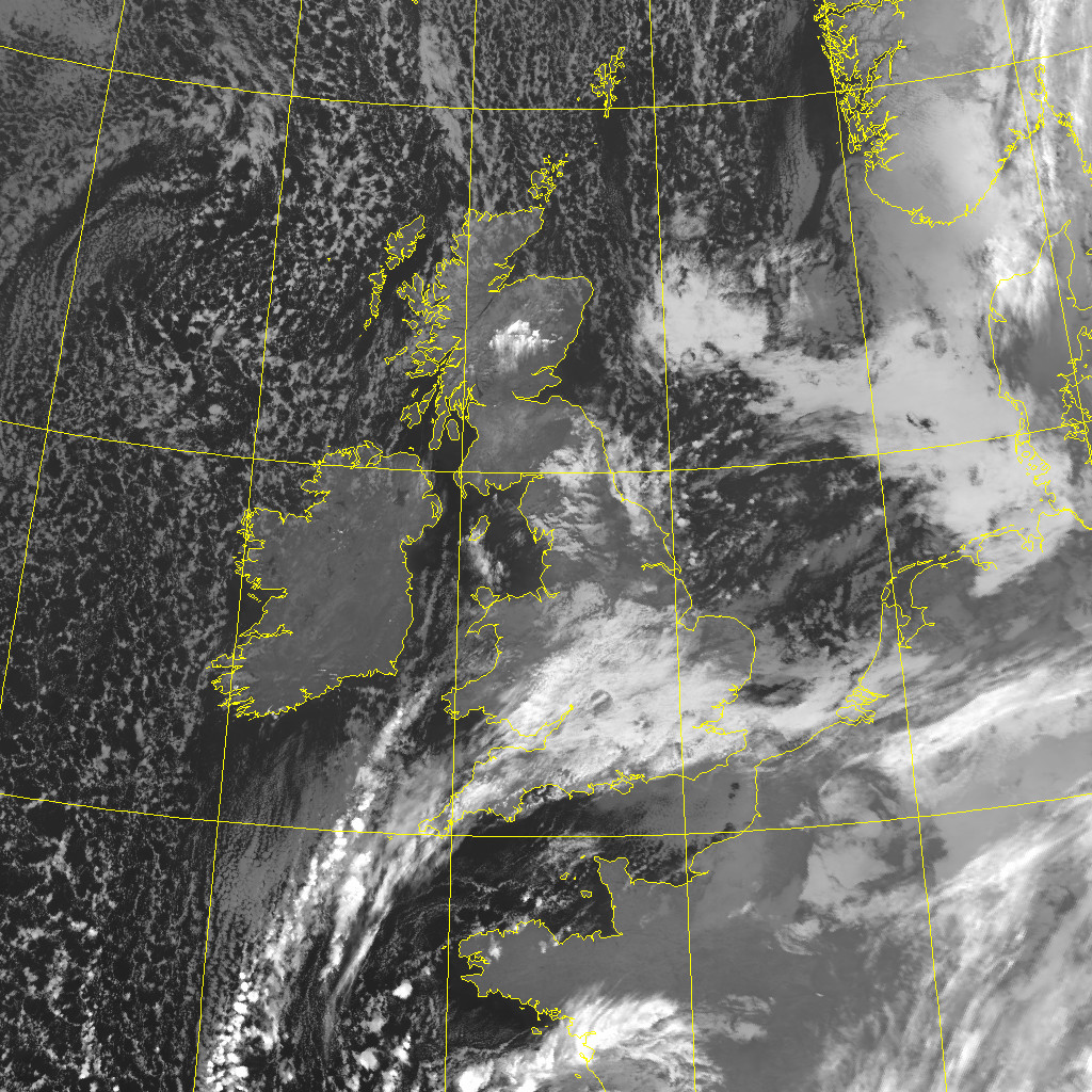
This infra-red images was taken by NOAA-19 on a south-bound pass, overhead at 07:51 on Friday 1st Jan 2021, which we re-projected to this 1024 x 1024 sized image (with the 5 degree grid lines and coast automatically overlaid). You can also get a 4k x 4k version which is 4MB and shows the resolution limit of the AVHRR scanner. However, it is still impressive for an instrument whose first design was flown in 1978 on the TIROS-N satellite!
![NOAA-19 pass at RAF Errol 07:51 01-01-2021 Image from the NOAA-19 satellite showing the UK on New Year's Day]()
Terra 21st Birthday (18 Dec 2020)
The satellite Terra was launched on the 18th Dec 1999 and today has its 21st birthday, an unusually long time for any satellite to remain in operation. While the MODIS sensor is showing some signs of degradation and it has been largely replaced by the newer NPP and NOAA-20 birds, it is still worthy of note. This quick look-image was taken around 12:03 today and shows the weather features bearing down on the UK.
![Terra pass at RAF Errol on its 21st birthday Image from the Terra satellite on its 21st birthday showing the UK]()
Errol Antennas (03 Dec 2020)
We have got to the stage of having two tracking antennas in routine operation. Here you can see those two antennas tracking, along with those still to be refurbished and put back in to service.
![The 3.7m (left) and 2.4m (right) antennas tracking at Errol Image of the first two operational antennas at the RAF Errol site]()
First Pass from Errol (15 Sep 2020)
We were able to receiver our first images at the new RAF Errol site using our 3.7m antenna with the X-band feed formally used in Dundee. While we still have a long way to go to be fully operational, it is good to finally see something in return for our efforts and all of the support we have been getting.
The current 3.7m pedestal dates from 1997 (though the reflector is from 1975) and was constructed to allow DSRS to take data from the NASA EOS satellites Terra and Aqua which were eventually launched on December 18, 1999 and May 4, 2002 respectively. Both have far exceeded their planned 6 year mission life, though the sensor data is poorer now than when new.
The image was taken by the satellite Terra on a south-bound pass, starting at 11:44:19 and ending 11:58:37 UTC. What is shown below is a quick-look generated at a fraction of the satellite's full resolution.
So it is kind of fitting that the first public image taken by the new DSS Ltd should be from a satellite that the pedestal was originally built to service, and given that satellite is now almost 21 years old it is able to buy us a celebratory drink!
![First overhead Terra pass at RAF Errol Image from the first overhead pass showing UK]()
DSS Ltd is one year old! (24 July 2020)
We are making progress on the new site and now have the equipment room wired for 3-phase power and hope to have antennas on concrete plinths within the next couple of weeks to allow for refurbishment and testing. There are still many small jobs to sort out and various key tasks have been delayed by the current pandemic, but we are seeing light at the end of the tunnel.
This web site, and the bigger task of resurrecting what was Scotland's only significant ground station, are still very much "work in progress" so please be patient with us!
Arrival of Equipment Room (20 May 2020)
We are now making good progress towards our ambition of a new and better facility. Our planning application for the new site was granted in Feb 2020 and on-site work started end of May 2020 (delayed by the COVID-19 lock-down) with the delivery of the metal "anti-vandal site office" that will form the equipment room and on-site office space.
We are also grateful for the professional support of Keir + Co in the application process.
![Arrival of Equipment Cabin Photo showing stored antennas, delivery vehicle, and new equipment cabin]()
-
Services Offered
Dundee Satellite Station Ltd is currently setting up ground station and R&D facilities at the former RAF Errol airfield.
We offer a range of services to the UK and International Space sector including reception and transmitting facilities in VHF, UHF, L-band, S-band, X-band and Ku-band as well as a range of consultancy services around this from RF through to data processing software, and integration to existing systems. We can provide quality support from your initial design phase looking at comms options and link budgets, through to "premium" ground station support (e.g. signal analysis and recording, orbit determination, etc) during critical phases such as LEOP or following anomalous behaviour, and on to cost-effective routine operations for data up and down links.
In current operation are 3.7m, 2.4m, and two 2.8m tracking antennas. Future plans include a 3.0m geostationary antenna and an upgrade to 5m for ones of the tracking systems. Further down the line we are already in discussion with other organisations with a view to providing an integrated service offering greater geographic coverage over more of Europe and with additional benefit of multiple-site resilience.
We can host 3rd party equipment and, subject to planning and civil engineering approval, 3rd party antennas on the site.
In addition to these spacecraft-operation support services we are now receiving Earth Observation data in real-time with a view to supporting both time-sensitive commercial applications as well as providing a broad range of archive data access for research and general public interest purposes.
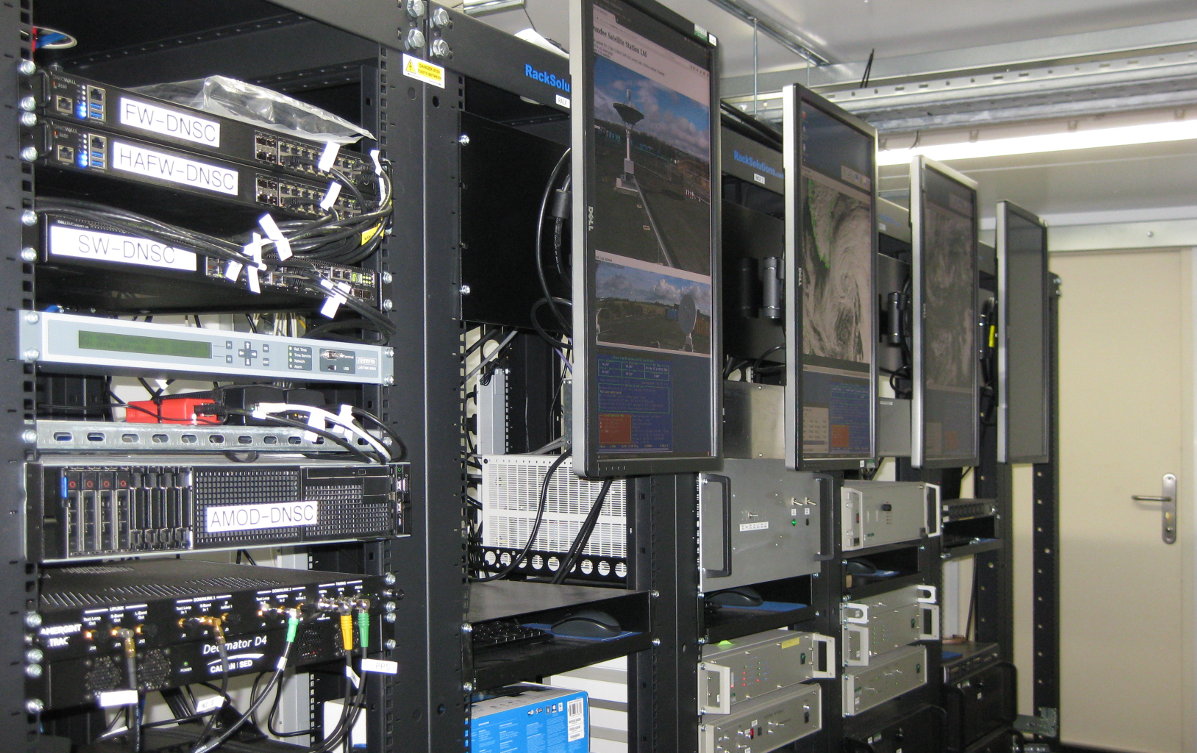
![Equipment Room Photo of equipment inside Errol site]()
Equipment room showing 19" racks -
Contact Information
Email address is: contact [at] DundeeSat.co.uk (modified to reduce spam).
Other details will follow soon.
Site address
Errol Ground Station,
Errol,
Perth,
PH2 7TB
UPRN 124112457
Legal
Dundee Satellite Station Ltd is registered in Scotland, UK, as SC636956.

